Widespread Snow Coming Wednesday Into Thursday, 12+ Inches Possible In Parts Of Massachusetts
BOSTON (CBS) -- The chatter continues and the calls for "bread and milk" are getting louder and louder by the day. The nor'easter picture for Wednesday night into Thursday is becoming clearer, but there are still some uncertainties about this storm. Let's start with what we do know.
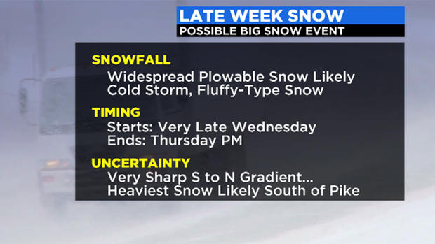
There will be a coastal storm forming off the Delmarva/Mid-Atlantic Coast later on Wednesday. There will be abundant snowfall north of the track of this storm. The air will be plenty cold enough for all snow in southern New England. Unlike the storm from earlier this month, this snow will be very light and fluffy (with exception of Outer Cape/Islands) and therefore accumulate quite quickly and easily.
We also know that thanks in large part to the storm passing to our south Monday, Thursday's storm will NOT be one of those rapidly deepening, bombogenesis events here in southern New England. Monday's storm became a monster up in the Maritimes and essentially stole some of the energy available for Thursday's storm. It will also serve to redirect the jet stream and steering currents quite a bit (to what degree we won't know for sure until Tuesday at least…). This means that Thursday's storm will actually be weakening as it passes to our south, likely peaking in power when it passes by New Jersey and Long Island.
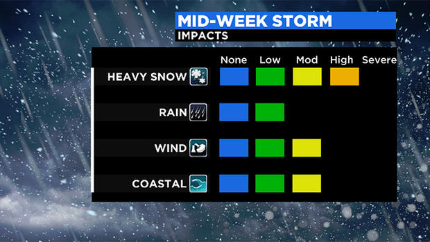
That said, there still may be some gusty winds. They may not be strong enough for widespread power outages, however, the 40mph+ gusts lead of visibility issues (thinking of snow blowing sideways).
TIMELINE
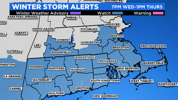
Snowfall arrives from southwest (Connecticut) to northeast (Essex county) between 8 p.m. and midnight Wednesday.
Steady, heavy snow makes it's farthest push north by about 7-8 a.m. Thursday and then starts to collapse and weaken, tapering off during Thursday midday/afternoon.
Worst commute: Thursday morning
Brunt of snow: 2-10 a.m. Thursday
SNOW AMOUNTS
These numbers and locations may fluctuate over the next day as the system closes in on the northeast. The area of low pressure in question is moving into the central Plains on Tuesday. Any nudge, north or south, in its track will mean a shift to the totals.
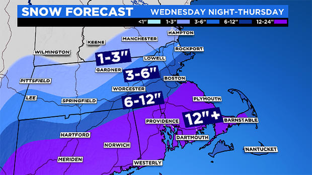
1-3 inches: In the areas where we normally see the heaviest snow! Northern Worcester County, southern New Hampshire (sorry ski areas)
3-6 inches: From Worcester to Lowell and Lawrence…outer 495 belt northwest of Boston
6-12 inches: Cape Ann to Boston and immediate suburbs southwest of the city…also outer Cape and Islands where snow won't be as fluffy
12+ inches: South Shore, most of CT. and R.I., chance for heavy banding here and snow should accumulate very quickly, can't rule out 18"+ amounts somewhere
WIND
Again, likely not a huge wind threat here with storm in weakening stages in our area…expect northeast gusts along the South Shore, Cape, and Islands to range between 35-55mph Thursday…winds much lower inland.
Power outage threat low given lack of high-end wind gusts and light/fluffy snow
COASTAL FLOODING
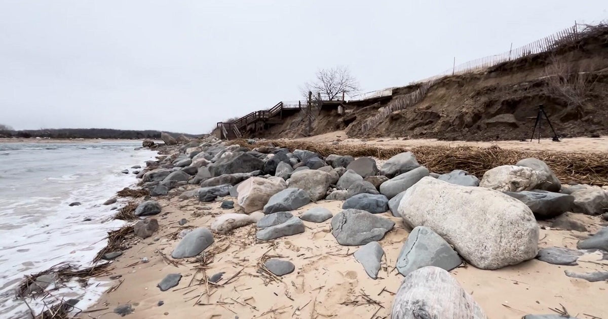
Tides will be astronomically high later this week so there is some concern for minor to moderate coastal flooding. The high tide of greatest concern would be the midday (12:52 p.m.) high tide on Thursday with a forecast height of 11.3' in Boston. We may see some splash over and coastal inundation in the typically prone areas between 11 a.m. and 3 p.m. Thursday. Minor beach erosion may be possible as well.
As always, we urge that you stay tuned to updates throughout the week on WBZ-TV, CBSBoston.com, and CBSN Boston
