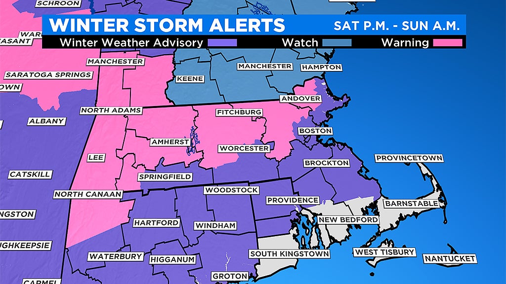
Plowable Snow Coming Late Saturday, Most North And West Of Boston
BOSTON (CBS) - A plowable snowfall is on the way this weekend for most of southern New England. Remarkably, for many folks, this will be the first plowable event in more than a month. That is awfully hard to do in the middle of winter here! Having said that, this should be a fairly low impact event, essentially just a quick moving burst of snow on a Saturday evening.
No wind or coastal concerns and for some folks a change to rain will compact what little snow they receive.
TIMELINE
The snow arrives from west to east between 4-to-7 p.m. It will be snowing in the Berkshires by 4 p.m. and into Boston around 7 p.m. The intensity will increase fairly quickly to as much as an inch per hour shortly after it starts.
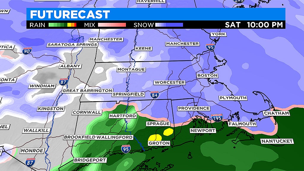
The majority of the snow accumulation will occur between 8 p.m. and 1 a.m. Towards the tail end of the storm, particularly in areas south of the Massachusetts Turnpike, the snow will change to a light rain before tapering off. The final drops and flakes will taper between 1 and 5 a.m. Very little additional accumulation will occur after 1 a.m. Sunday. So, get up Sunday morning, have your coffee and head on out to clean up the driveway.
HOW MUCH?
Coating to 2 inches: Areas south of Plymouth including the South Coast, Cape Cod and the Islands and, with a change to rain down here, much of the snow will be compacted or washed away.
2-to-4 inches: The region from Boston to Providence, including much of Norfolk County and northern Plymouth and Bristol counties. Again, with some change to rain very late, this may be compacted a bit.
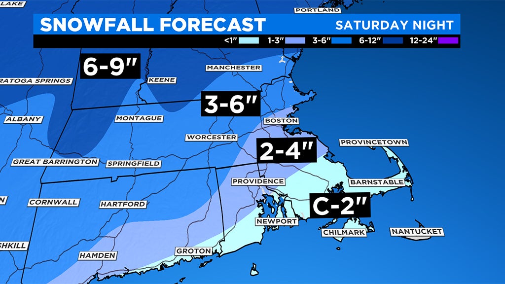
3-to-6 inches: All areas north and west of Boston. This includes Worcester (much of Worcester County) and most of Middlesex and Essex counties as well as New Hampshire, Vermont and southern Maine.
There will be a bit of a fluff factor in these areas with very cold temperatures, especially at the start of the storm.
Best chance of more than 6": Northern Worcester County, Monadnock Region, northern Berkshires, Green and White Mountains…ski areas rejoice! Again, major fluff factor here, very light and fluffy snow will pile up fairly quickly.
WHAT'S NEXT?
It appears that we will enter a prolonged stretch of cold and dry weather once this storm departs.
The highs for most of next week will remain in the 20s and 30s, so whatever snow is left on the ground after this weekend will be sticking around a while.
Follow Terry on Twitter @TerryWBZ