Bitter Blast...
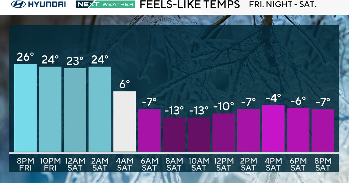
As we head into the weekend all eyes are on the Prairies of Canada where an abnormally cold arctic airmass has been building and is expanding across the border into the US. The leading edge is an Arctic Front which will pass through early Sunday morning with a few snow showers then the cold pours in and it means business. Temps will start in the mid 20s and won't climb much...we are looking at highs near 30 but with an extremely gusty wind windchills will be in the teens all day long. Pats and Broncos play Sunday evening in brutally cold conditions...windchills in the single digits!
As far as Thanksgiving week goes...signs continue to point to a powerful storm during the middle of the week. With extreme cold recharging over the Midwest and water ocean water temps, a storm is likely to blow up off the East Coast and it looks like the greatest impact would be on Wednesday. It's tough to get specific this far out considering the final track is not locked in and won't be for many days but taking all variables into account rain and wind along the coast and snow for interior New England is looking more and more likely. Obviously, if this storm holds close to current projections there will be major travel delays up and down the East Coast...
Have a great weekend!


