Clouding Christmas...A Midweek Nor'easter...A Mix of Rain & Snow
Cold high pressure sits over us on Christmas eve night. Clear cold calm dry air is allowing temps to fall into the teens overnight in most areas. The high will push off the coast tomorrow and begin to wrap in a warmer SW winds. After a cold start to Christmas morning temps will rise in the afternoon back to near 40 by the afternoon.
A strong vortmax is sliding from the Great Lakes through New England on Christmas day. Skies will start out bright with sunshine in the early morning. Clouds will be on the increase through the day. Mostly cloudy skies by the afternoon. There is a risk of a few scattered snow showers and flurries forming in northern and western New England. A light coasting will be possible in spots. These will likely mix with light showers or sprinkles later in the day for Boston south. Once this vortmax (front) pushes through clouds will break after midnight and the scattered light wintry precip should shut off too. Ocean effect snow showers will be possible on the Cape. Energy from the south will try to ride up along this front late in the day...but it never quite gets it's act going over us...but this does allow for a deepening low well off the New England coast early Monday morning with breezy NW winds bringing in dry air, sunshine and temps in the lwr 40's for highs.
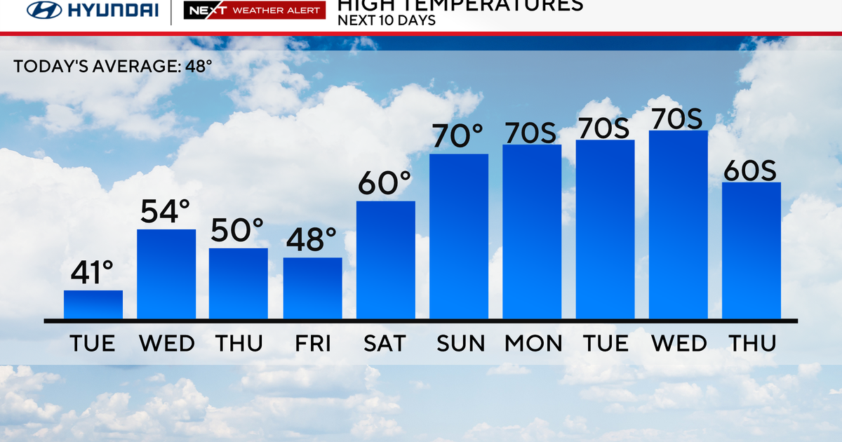
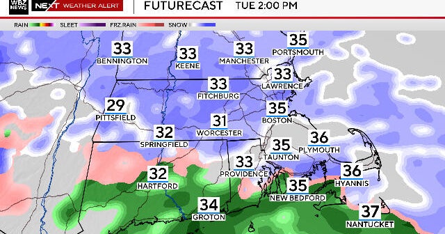
We will be watching moisture coming out of the Gulf and being directed towards New England Tuesday. Winds will be out of the SW, so with increasing clouds, temps will be climbing well into the 40's and maybe a few Lwr 50's for SE MA. This low will be loaded with moisture. The question this far out is the exact track this storm is going to take. This will determine who sees rain or snow. The timing appears to have showers developing later in the day Tuesday with rain becoming heavy Tuesday night. Today temps appear cold enough for precip to start as snow/mix in Northern New England late Tuesday into the evening. With the low tracking over us, this will mean mostly rain for southern New England...and it will be heavy at times. Sow will push up and be confined in the NW mountains of New England. The storm will quickly be pulling away Wednesday morning early...taking the snow across the north with it. Most of us will see the rain quickly ending with skies becoming partly sunny Wednesday with gusty NW winds on the back side making temps fall right through the afternoon. This storm will come with about .75-1.5" of water. The heaviest snow will likely be confined across central and Northern VT & NH. Any shift in track of the low farther east or south could bring the heavier snow closer to the Mondanock region or Bershires...but for now...snow is far to the north and west. Some ski areas could pick up a foot of snow or more from this.
We will just have to keep an eye on this storm in the next few days and keep you up to date with any changes. Merry Christmas to all and to all a good night! ZZZZZ.
