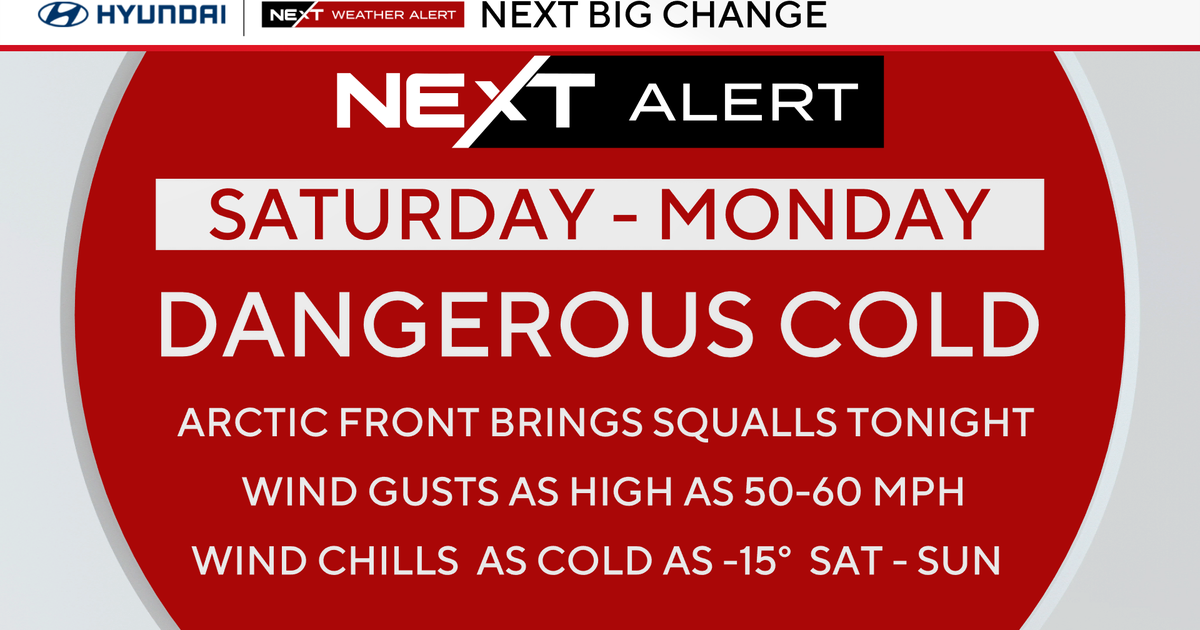
Another Cold Night...
Here we go again, the sky is clearing, the air is very dry and this night is going to be very cold. It will be a dangerously cold night for those that are waiting out the power outage in their homes without generator power or a way to burn wood. The dense snowpack across most of the Bay State will act like a refrigerant and chill the air down into the 20s. Thankfully, the days are about to get warmer as mid level temps are on the rise and will translate down to the surface in the form of 50s to around 60 both tomorrow and Thursday.
Following that a mini shot of cold air that lasts for a couple of days. A coldfront (dry one) will pass thru very early Friday morning and gusty NW winds will advect even colder air into the region...highs on Friday will be around 50 and on Saturday all will struggle to get thru the 40s!
The cold snap will be short lived...high pressure will slide off the coast and return flow will pump unseasonably warm temps into New England...so warm that not only will 60s be attainable but so might 70!