Another Biggie...
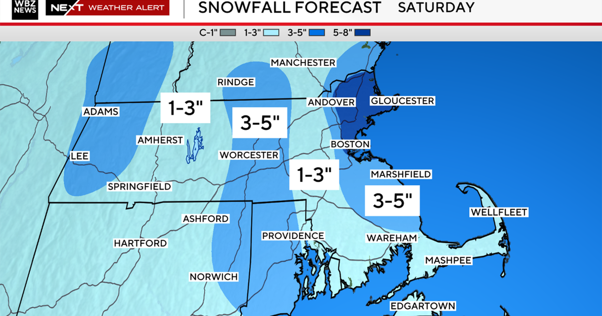
Another Nor'easter is on the way and while this one won't be as destructive as Superstorm Sandy and will throw us a variety of problems. The storm is now taking shape off of North Carolina and will strengthen overnight with good upper level dynamics from the jetstream. By morning, clouds will be overspreading the area from the south and the wind will begin picking up out of the NE. The clouds will lower and thicken up and we may actually even see a few flurries due to ocean effect early in the day well out ahead of the main batch of precip. The main batch will work in mid to late afternoon, also from the south and will start off as raindrops for most inside of 495. Just because the precip may start as rain doesn't mean it will stay rain. Surface temps will fall for a number of reasons early in the evening...the setting sun, evaporational cooling and heavy precip will all work to lower temps in the column. This will mean wet snowflakes will start working in, and in places west of 128, there may be a complete change to snow for a few hours. The result will be a minor accumulation of snow with towns in and around Boston seeing a thin coating on the grass or cartop...128 to 495 towns may see up to an inch of slushy snow...west of 495 towns will see 1-3 inches with locally higher amounts in the mountains. In all cases, I don't see much more than wet roadways...except of course in the 2-3 inch zone.
Winds will be gusty as well with the strongest wind working down tomorrow night. There is a High Wind Warning for the South Coast of New England where gusts could eclipse 60 mph and a Wind Advisory for the rest of Eastern MA for gusts to 50 mph. Scattered power outages and pockets of tree damage will be likely.
The coastline will take another beating, with large waves and a 1-3 foot storm surge creating minor coastal flooding and beach erosion. This time around it will be the east and northeast facing beaches that get it the worst. The two high tides we are most concerned with are Wednesday evening high tide between 5-6PM and the Thursday morning high tide between 5-7AM.
This storm will be a run of the mill Nor'easter, but because many will see the first flakes of the season it will be a bit surpising.


