A Wintry Look To The First Days of Spring
As we have been advertising here on this blog for some time...there would be a return of the trough to the Northeast for late March. With the trough comes cooler than normal temps, a storm track further south and at least the potential for a few chances of snow before spring starts to settle in for the long haul. The pattern is just starting to change. After a nice spring thaw the past two days...temperatures are going to start heading down hill for the forseeable future. While this pattern plays out...some will be wondering where and when will spring ever arrive. Yesterday was a cruel tease. You knew it couldn't last.
Weekend Outlook
Pretty Straight forward this weekend. A cold front has moved through and this is providing a cooler Northerly wind to the region with a return to seasonal temps in the Lwr-mid 40's. Clouds have been breaking the morning. Skies will continue to increase with sunshine this afternoon as skies will clear just in time for the full Worm moon tonight. High pressure builds towards new England Sunday with lighter winds and even more sunshine. Cool NE winds out of the NE will make it feel cooler at the coast near 40-42...but milder temps in land will range from 42-46 degrees. The parade in Southie will be perfect with sunfilled skies and temps in the Lwr 40's
Monday's Mix
We will be tracking a weak little short wave Monday. It will be arriving in the morning with temps cold enough across the north that this will likely snow across the north. Early thinking is 1-3" of snow in SNH, S.ME and S. VT, 3-6" snow across N.VT, N. NH...with the potential for 6-8" of snow from Augusta to Bar Harbor ME. Snow will be changing to rain in the afternoon. Southern New England could see an early burst of snow before a quick change to rain with about .10-.50" at the most likely. Skies will clear monday night with gusty NW winds and big Canadian High pressure follows in behind.
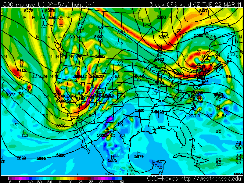
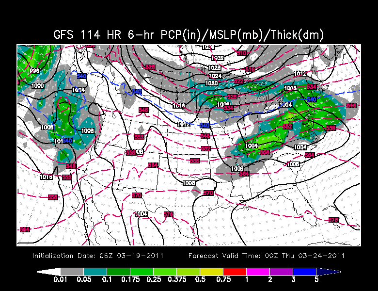
A coastal low currently along the west coast of the US will be the next weather maker to watch for the midweek. I leaned towards a drier approach for the midweek on television the morning...as I feel the High will provide just enough dry air and subsidence to help direct this low south of New England. Still east winds, along with the approaching low, this will make for considerable clouds and a very chilly raw feeling at the coast. We should be able to squeeze out a dry Wednesday, but the northern fringe of this low will likely push into the region Wednesday Night or Thursday for a period of light snow fall! We could remain mostly dry at the coast. Something to watch in the coming days. It is hard to say who is going to win this one...but this morning I leaned towards the High....but this will be the second low in a week to give us another chance of snow.
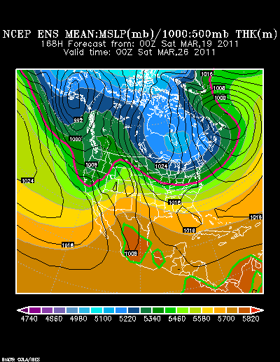
Heading into Next weekend a Huge cold high comes in from Canada which will provide dry but cooler than normal temperatures.
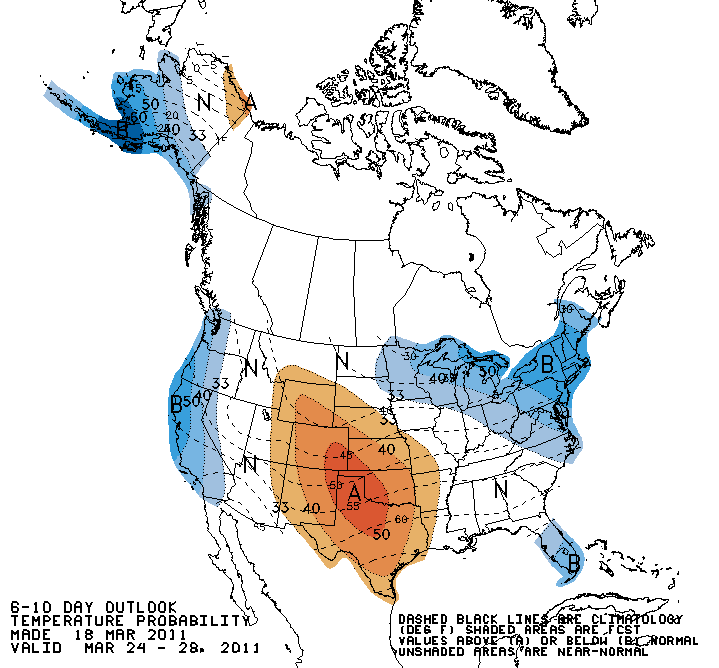
The Climate Prediction Centers forecast for the next 6-14 days is for below normal temperatures across the Northeast
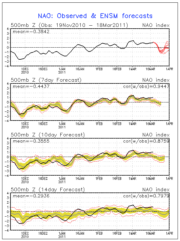
A blocking pattern is starting to show signs of redeveloping in Canada as the NAO is expected to go back into Negative territory. Heading to April, it seems the NAO will trend back to neutral or positive.
This blocking pattern is going to get into a very active "bowling ball" pattern going where it will be one storm after the other to end out the month of March. The storm track appears to take a series of lows south of New England from the 26th-31st....any change of track could provide the region of chance of snow with these potent lows which will be skirting just south of us moving through the southeast and mid-Atlantic states.
Moral of the story...There is some active weather coming our way for the end of March with very little signs of any springlike warmth for now. There will be a few days with a real winter feel. Don't put those jackets away yet!
