A Wild Night..Then A Look Ahead
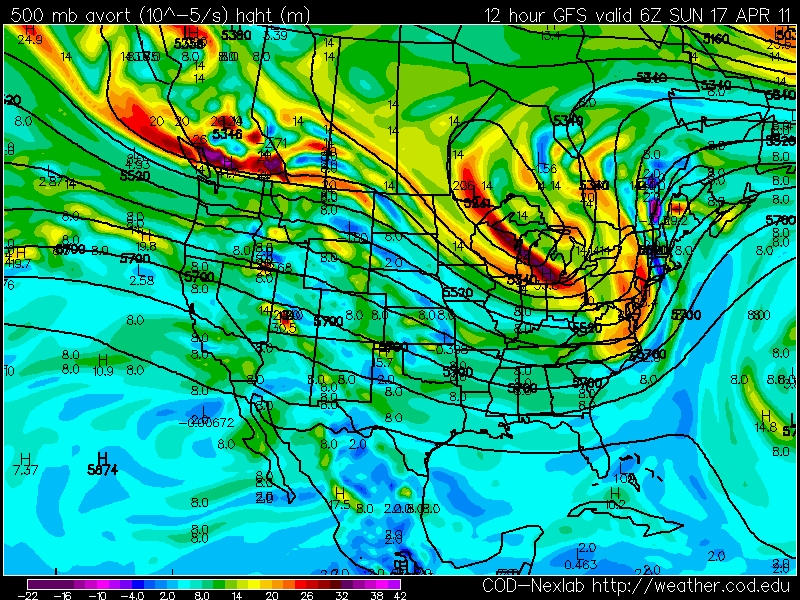
After a showery and breezy start it is going to start to get mighty interesting around here for the next few hours. The tornado outbreak is finally coming to an end, but upper level winds are steering that energy, and moisture up the east coast in the form of thunderstorms. Looking at the 500 mb Vort chart below...you can see that New England is in a perfect place for tremendous lift and elevated thunderstorms. Upper level diffluence aloft with a tremendous vortmax will cross over the region around midnight and the early morning hours after. Heavy rain and embedded thunderstorms are likely. Temperatures have been so cold today, this will have a stabilizing influence on some of the storms which should prevent them from going severe during the overnight...but you can not totally rule it out either because of the energy in play here. This is after all the remnants of a system which has spawned 200 tornadoes in 3 days...80 which occurred today!
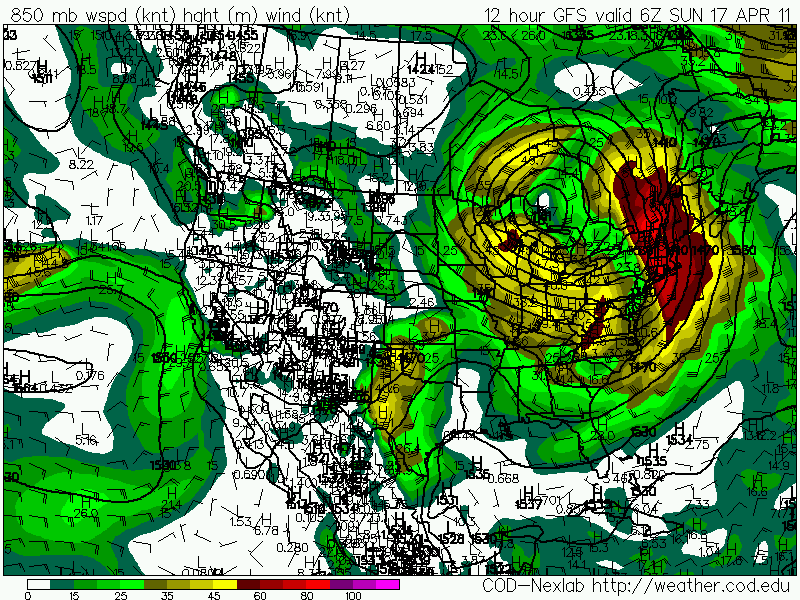
The Low level jet is racing just a few thousand feet up this evening with winds 65 to 80 knts. As this low level jet crosses New England tonight, some of these winds may mix down in the downpours and thunderstorms for scattered wind damage with winds gusting over 50 mph in spots.
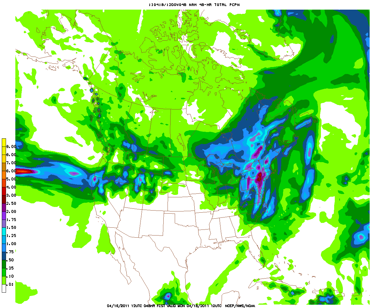
The rain is ging to come down in buckets between 12 AM-6 AM Sunday. Luckily, it will be quick moving so no big flooding issues are anticipated. A widespread 1-2" rainfall is likely with less amounts on the Cape. There may be a few areas who get over 2" if caught in area with slow moving torrential rain. Once past 3" of rain...that is threshold we have to watch for flooding. Most will remain below that. You can see from the QPF forecast below...the heavier rain will likely occur in the west and weaken a tad towards the coast.
This front will be quickly pushing off the coast Sunday with skies becoming partly sunny. Breezy west winds will push temps back into the Lwr 60's. Patriots day will be a beauty with morning sunshine and a few afternoon clouds. Winds could gust to 25 to 30...so active tailwinds are likely with temps nearing 60 by afternoon.
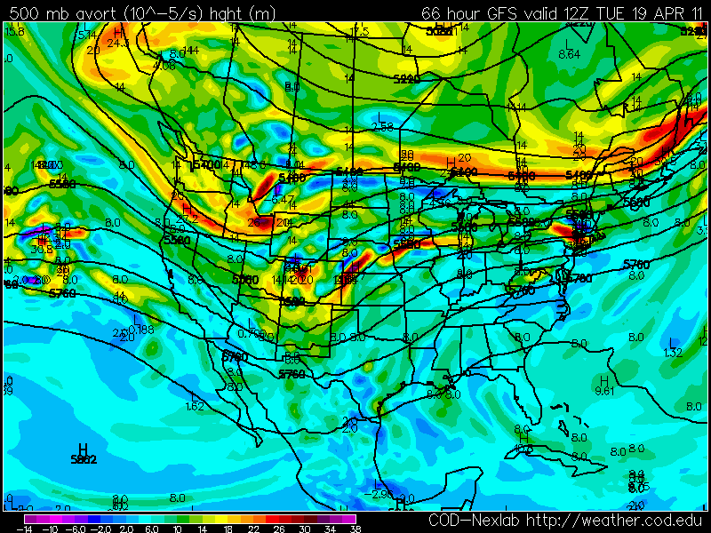
Looking ahead towards Tuesday, the upper level winds a directed from the Great lakes right through New England. The jetstream acts as a thermostat directing airmasses around the globe. In this pattern, warm air will be coming out of the Gulf, yet cooler air from Canada will be in place along the Canadian border.
This will establish a boundary between the differing airmasses which is pretty clear looking at the 850 mb temps. This warm front will be south of New England Tuesday with NE winds at the surface. This will mean we are back in the chill of the 40's with clouds and showers. 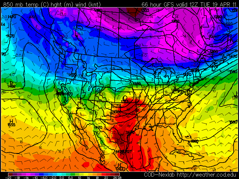
The low in the Plains will track up through the Great Lakes and west of New England. There is a concern the warm front could get hung up Wednesday and prevent the warm sector from pushing into the region...keeping cloudy, damp, cooler conditions...especially along the coast. By the end of Wednesday we should be able to break into at least a little sun...before the cold front sweeps through with a few late day showers and brings in more pleasant weather to end the week Thur-Fri in the 50's nearing 60.
Moral of the story is no big warm ups this week...but there will be plenty of nice moments to enjoy along the way. Good weather starts tomorrow and continues right through the Marathon! Now get your popcorn ready...this could be a show tonight!
