A Focus On The Midweek Rainstorm...
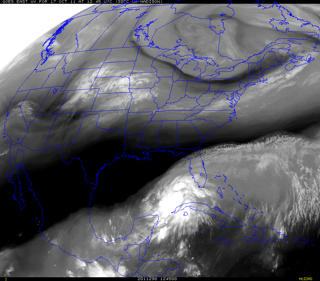
A look of the Water Vapor Satellite shows our weather today still being influence by the Upper Low in place near James Bay. Dry westerly winds are shifting in behind a spoke of energy which moved through last night. This was a weak front accompanied with a few scattered showers which has pushed off the coast where this front will stall. Skies have cleared for mostly sunny skies and breezy conditions today...Highs will again be in the mid-upper 60's.
2 other noticeable features on the Satellite...the low in the Midwest and the Low in the Caribbean. Both of these lows have their eyes set on coming into the Northeast to what is likely to become a significant storm for the eastern seaboard. Luckily it's fast moving, progressive movement should help to alleviate any big problems.
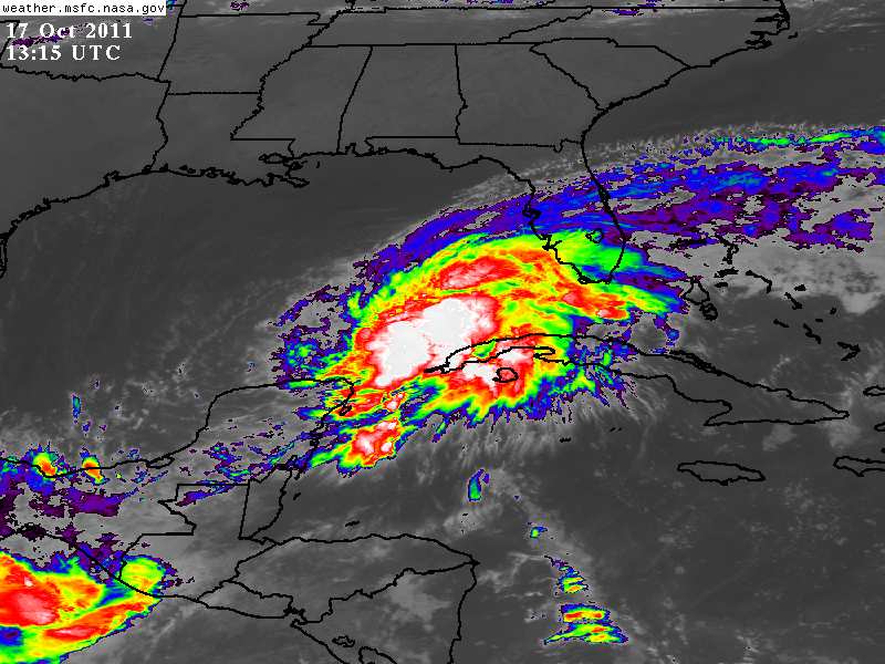
First, the enhanced Infrared satellite image of the tropical low off the coast of Cuba which has not even been named a depression, but is likely already a tropical storm and should be named by now for the sake of awareness to the population of Florida. Hurricane hunter aircraft is flying in this afternoon when this should become Tropical Storm Rina. Named or not, this will provide Flooding rains for Florida.
Energy piling over a ridge in the west spills in from the midwest to form a deep trough for the eastern half of the nation. The upper level winds will reach all the way down towards the Gulf and help to direct this "Tropical Low" up the east coast. The Midwest low will deepen under the Upper Low and track through the Ohio Valley/Great Lakes. Meanwhile, The upper level winds will be directing copious amounts of wind and rain right up the seaboard.
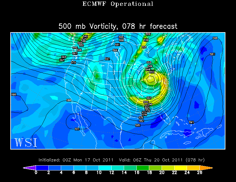
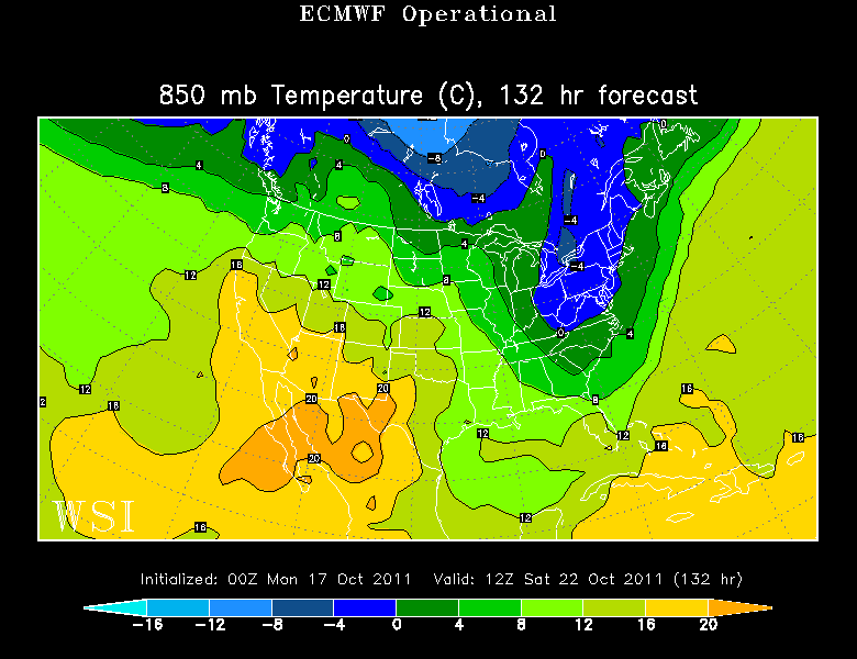
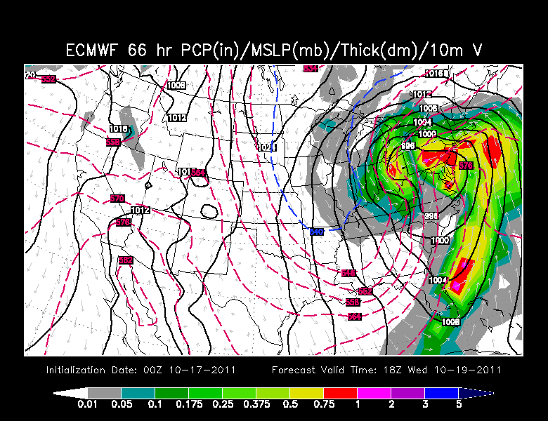
On the 00Z Euro run, you can see there are two low...one over Ohio and once tracking up through the Mid-Atlantic states. A fully mature mid-latitude cyclone that if this was winter we would be looking at a major snow storm. Luckily, that is not the case. Still, most models are showing this powerful push of wind and rain with a secondary warm core low tracking inland.
I think it is important to stress that the exact track and timing is still not figured out here as we are still seeing a variety of solutions. A few of the models keeping the Heaviest of the wind and rain offshore so it is not that big of a deal. So a little more time and analysis is needed, but what I want to show you is we are dealing with a potent storm which will likely last for 12 hours mainly happening Wednesday with linger effects into Thursday..
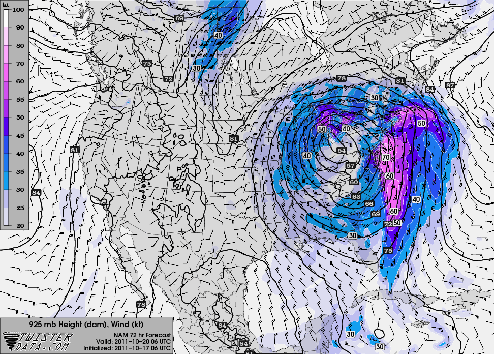
This is the NAM 925 mb winds. This shows a core of 60-70 kt winds just above the surface racing up the coast and wrapping into this low. If those winds mix down there is the possibility of damaging winds with this storm...especially at the coast. My thinking is we are likely going to see wind gusts in the 35-50 mph range for a time for our east and south facing coastlines.
Strong drying winds out of the SW will shift in behind the departing low which could still make it quite windy into Thursday.
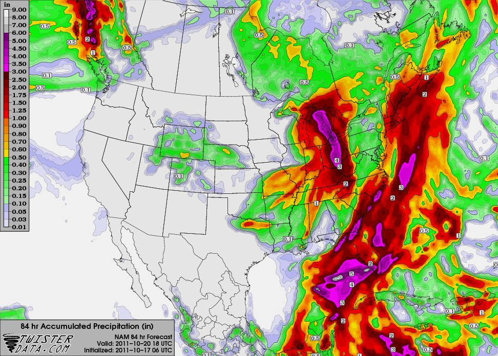
The NAM also projects heavy rainfall across the region in the order of 1-3", While the GFS at the latest run is keeping the heaviest rain and wind offshore. This can all change. Right now, I think it is good to discuss the possibilities and prepare for a windswept rainstorm which will be quick moving but come with tropical rainfall and the potential for some damaging wind gusts. I widespread 1-2" is likely with pockets upto 3"
Once this upper low pulls out, the rain and wind will go with it...but still the trough will remain across the Northeast. Cool air will settle in with breeze NW from Canada. Temps will only be in the 50's this weekend. Cooler air aloft will make for plenty of building diurnal cumulus with the daytime heating.
