A Beautiful Weekend, Then Things Get Interesting
Find Eric Fisher on Twitter and Facebook
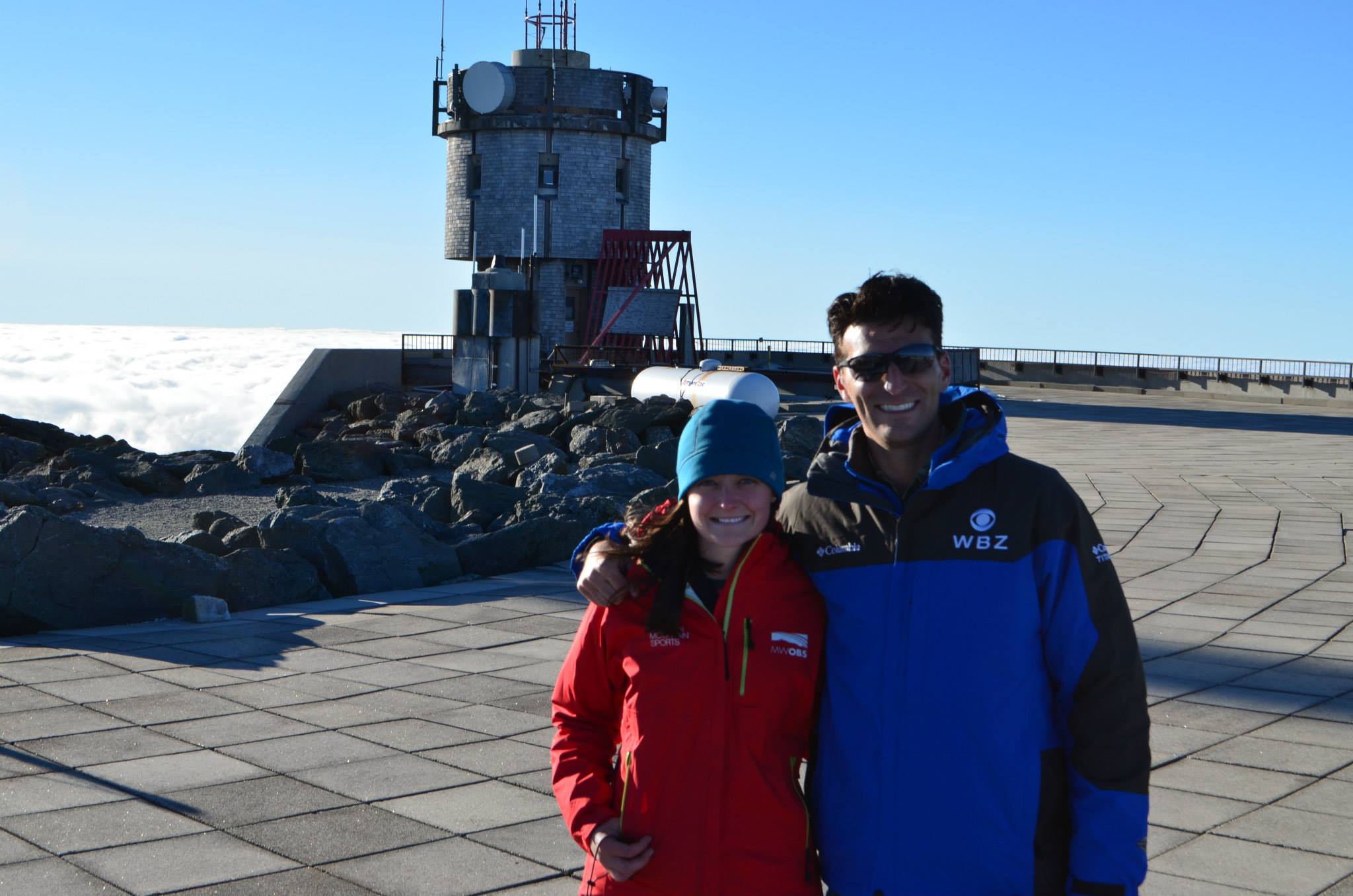
First things first...I hope you had a chance to catch our trip up to Mt. Washington on Thursday! The crew at the Observatory was outstanding, and we had incredible weather to showcase from the summit. Leftover snow, undercast (the clouds below us), a wonderful sunset. Couldn't ask for much more. You can watch some of the clips on my YouTube Channel, and see the photos on my Facebook page. A big thank you to our crew and the summit crew for making it a memorable day.
Observer Rebecca Scholand of MWObs. Photo Courtesy: Eric Fisher
Onward to the weekend, the final one of September! And it's looking like a stunner. I don't have much to really add, which is always a good sign when it comes to weather. High pressure will sit directly overhead on Saturday providing abundant sunshine and generally light winds. A sea breeze will develop at the coast, knocking temperatures back through the 60s. Inland areas should reach the low 70s. Excellent news for the Big E's final weekend, the Phantom Gourmet Food Festival, opening weekend of the Fryeburg Fair, or whatever you have planned outdoors!
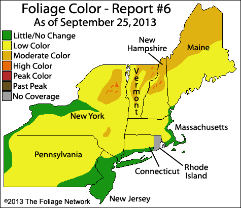
Foliage report from the Foliage Network
After a perfect Saturday night, Sunday will feature much of the same. The only thing that will change is that some cirrus clouds should start moving in overhead during the afternoon, especially along the South Coast and the Cape/Islands. But no major impact on your enjoyment factor! It's *after* this weekend that things get interesting.
We've been talking about a potential coastal storm all week, and now models are starting to trend back farther to the west after an initial trend out to sea. What that means for us is that some impacts for New England are looking more likely, especially since we're now into closer forecast range (3 days out). Let's take a look at what's going on here...
First off, where is out weather coming from? If you look at this satellite loop, the area in question is the disturbed weather south of Bermuda. Nothing too organized at this point, just some thunderstorms.
 IR Satellite Imagery from NOAA
This area is expected to take an odd track. It will first move out to sea, then take a U-Turn and head westward back toward the coast. It's a path somewhat similar to Sandy last year, but a *much* different animal. Whatever happens here would not even come close to that kind of impact. So no worries there.
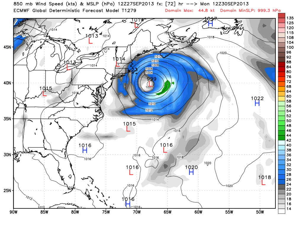
The ECMWF (European) model, which several days ago was the first to hint at a possible 'landfall,' is now the one farthest out to sea! You've got to love forecasting, right? Here's its solution for Monday. Yes, some rain; but not too much to write home about.
ECMWF for Monday, via WeatherBell
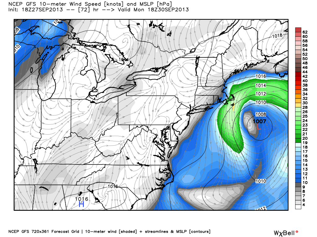
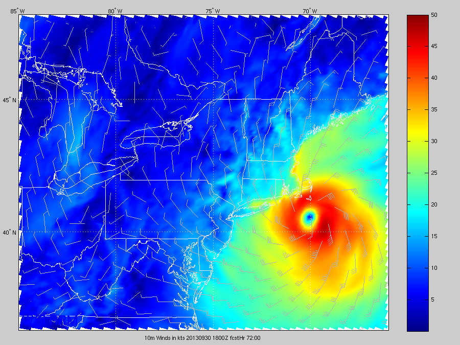
The GFS (American) and RPM (Rapid Precision Model from Weather Services International) are the most bullish for a higher impact event. The GFS brings in more rainfall, and also some pretty gusty winds for Cape Cod & the Islands. In all likelihood, we'd be talking about gusts 25-40mph, so nothing the Cape couldn't handle. Even if the storm wraps up and overachieves, it would still stay shy of a damaging event. While the RPM shows a well defined circulation, note that the wind speeds at 10m are still pretty marginal. I've also noticed in past events that the RPM really tends to want to wrap storms up and overplays an 'eye' structure, so it may look at lot meaner in the model presentation then it would actually be.
GFS for Monday, via WeatherBell
RPM for Monday afternoon, via WSI
The other question here is whether or not this storm would be tropical in nature. Given where it will start developing, and its time over warm-enough water, it may start to take on some tropical characteristics. By the time it reaches our latitude, it would be picking up more typical coastal storm characteristics. So if its winds can crank up fast enough, it may become what we would call a 'subtropical' storm. Those types of storms share some of both characteristics, and do receive names from the National Hurricane Center. If this thing can get organized enough, then it could eventually be named 'Jerry.' But that seems a fairly long shot at this point.
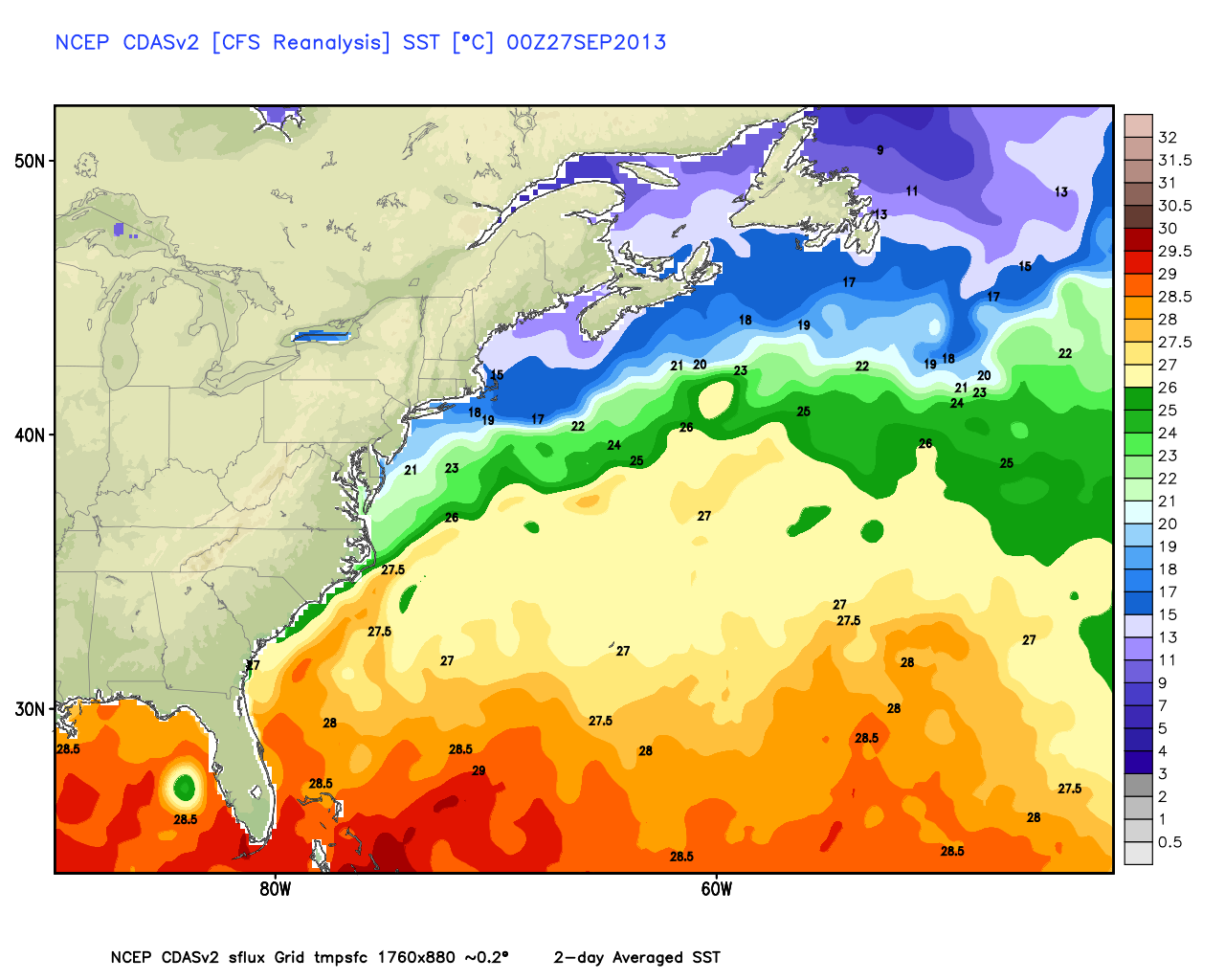
Also, the path of the storm will take it over the Gulf Stream. While not bathtub warm, it's still warm enough to supply some extra juice. One it hits our neighborhood, those warm temps cool off very quickly.
Current SST, via WeatherBell
The bottom line: It's looking increasingly likely that we'll end up with an impactful event on Monday, perhaps lingering into Tuesday morning. Those impacts would include gusty winds for SE Mass, and some bands of heavy rain. The rainfall may extend back toward Boston, the NH Seacoast, and RI. It's not looking too likely that the significant rain would penetrate too much farther westward than that. Clouds will likely be the rule on Monday, and temperatures will be cool in the 60s. At this time, I do *not* think the storm will become powerful enough to be damaging for the region. And for more good news, tides are astronomically low to coincide with the storms' approach. But since it's still 3 days out, stay tuned for any changes!
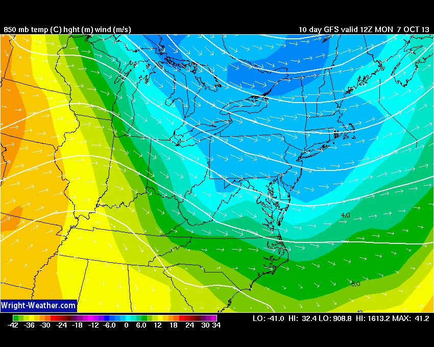
Once it departs on Tuesday, we're in for a mild stretch for the rest of the week. Winds will turn more westerly, and we should be in the 70s for Wednesday-Saturday. So gardens will keep on growing if you haven't seen a frost yet, and foliage will be in no major rush to start turning south of the mountains. BUT, there are indications for a much stormier/colder regime come next weekend. Right now, the GFS is broadcasting the coldest air of the season so far coming on down. But that's a loooooong way out, so we'll see if it verifies! Definitely something to watch if you have agricultural concerns in the region.
