A Hint Of Sun For The Weekend
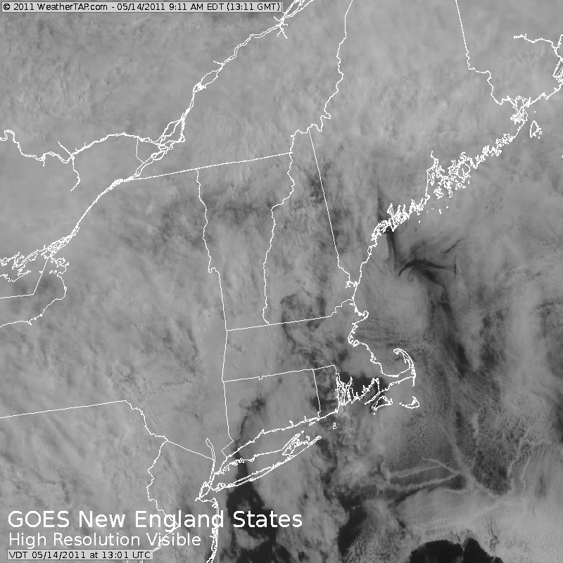
Plenty of low clouds and fog at the coast this morning. Clouds are already breaking inland giving way to some partial sun thanks to high pressure off the coast. Winds are light out of the SSE with plenty of cloud cover around today. Still, any breaks will be appreciated and help turn this Saturday into the pick of the weekend with dry and mild conditions with highs climbing into the upper 60s and lwr 70s away from the coast. Breaks of sun are likely through the early afternoon with clouds spreading from west to east from New York state to end the day on the cloudy side.
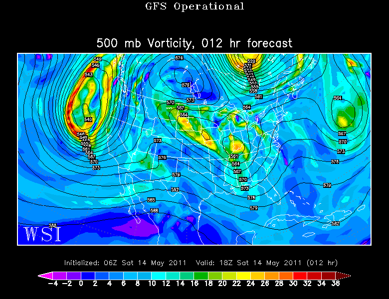
A cold front is across the canadian border which will become the focus for showers in the next 24 hours. As this front begins to push south, it will likely trigger showers across the north and western new england this evening.
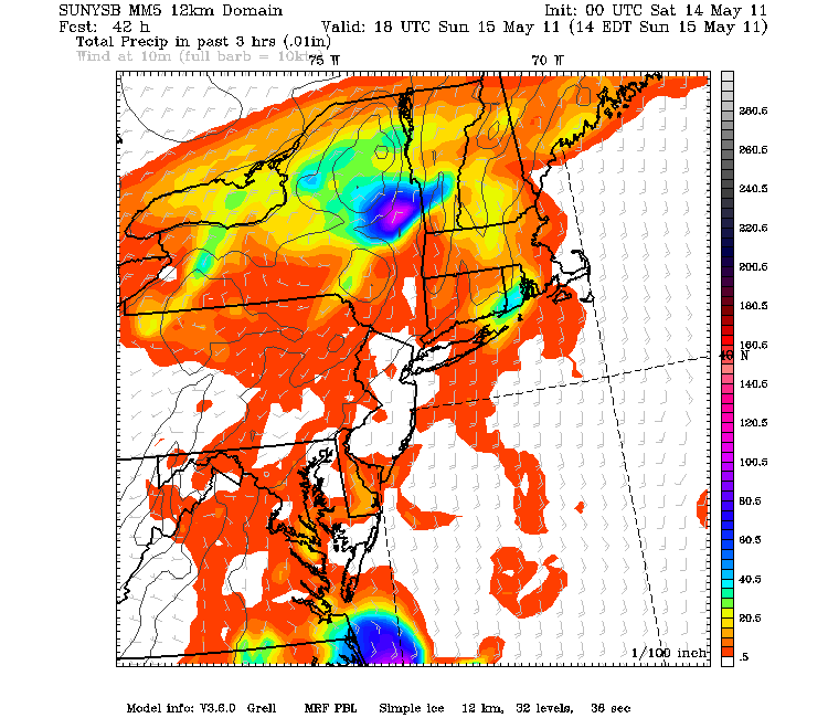
Showers will continue to push south and east for Sunday along this stalling front over New England. The showers will likely develop in the morning with the steadiest rain waiting until midday into the afternoon...A few downpours are possible...then the rain will become lighter with pockets of drizzle.
Southerly flow aloft Monday will continue to transport warm humid air northward. The placement of the stalled front remains in question in the extended outlook. On the cooler side of the front, NE winds will keep temps will be in the 50's, on the warmer more humid side of the front SE winds will push temps into the 60's.
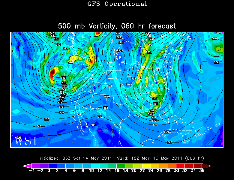
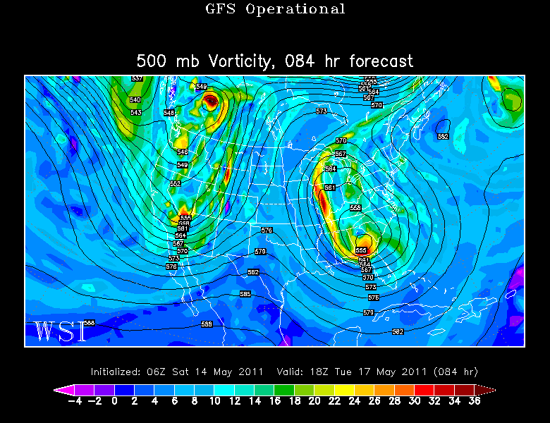
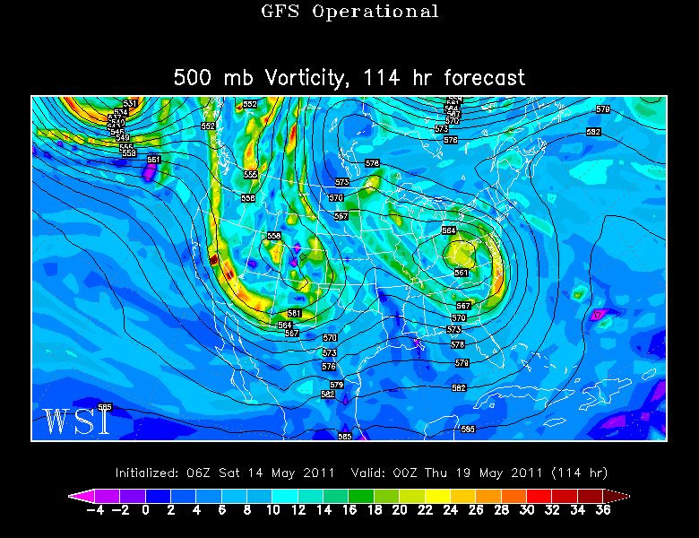
I think we all know by now what kind of pattern is ahead. The timing and placement and intensity of the showers is still up in the air. So we look at where the air is coming from. you can see below a deep trough tapping into tropical air and directing it up the coast. The air will be loaded with moisture...so it is hard to say exactly when it will rain with any confidence...but when it does rain it will pour...for a time. Monday appears to be cool , showery with drizzle. Still, it could briefly rain heavily just about any time with the front stalled over us.
The upper Low will be digging in for the long haul Tuesday with a moist feed being directed right into New England off the water. This pattern remains in place through the midweek. Timing several shortwaves moving through will mean periods of heavier rain and periodic lulls.
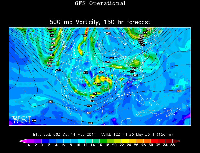
The slow moving upper low will begin to weaken over us by the end of the week, which may provide a break in the pattern. Still enough lift and instability to keep the chance of shower until the end of the week. The Euro has shown the ridge offshore strengthening enough to push the heaviest rain west of new England through the midweek for a drier extended outlook...but for now I have decided to keep the steady chance of showers in place for much of th week ahead looking at this setup. The pattern will definitely be losing steam by the end of the week for seasonal temps and a better chance of seeing the sun.
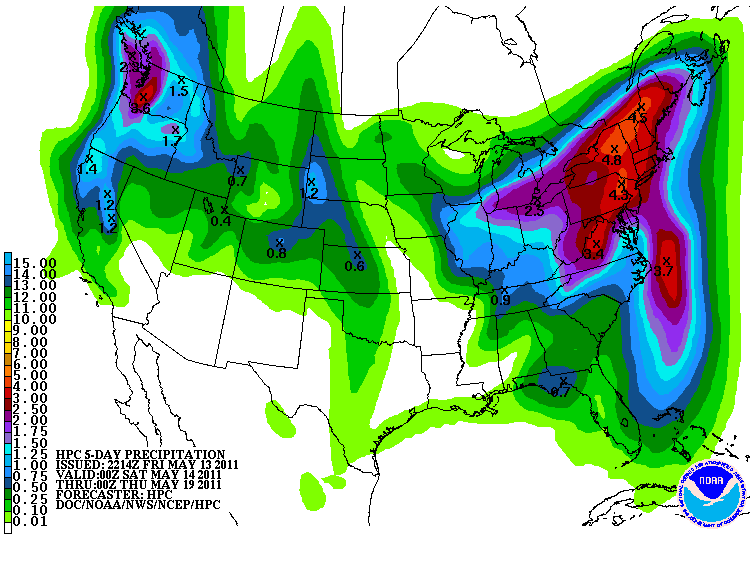
Again, where and when the heaviest rain will fall is hard to say...but there for a major rain event in the Northeast with 2-4" rain possible especially in areas which get into some tropical downpours during the midweek.
