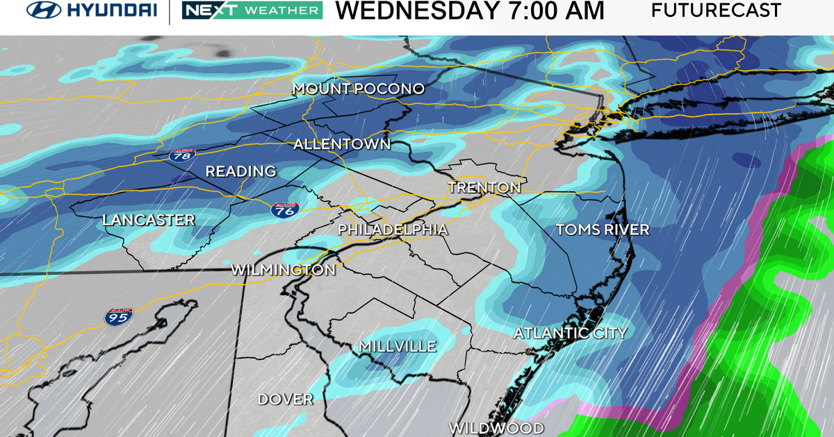
Weather Alert Day For Saturday Due to Potential Nor'easter
BALTIMORE (WJZ) -- The WJZ First Alert Weather Team has issued an Alert Day for Saturday.
A coastal storm will bring us a variety of impacts including snow showers, slick roads, gusty winds and the potential for coastal flooding.
While we are confident we'll see accumulating snow, there is still uncertainty about how much we will get, particularly in the Baltimore metro area.
Snow is expected to begin later in the day on Friday with the bulk of it falling overnight into Saturday morning.
So far, it looks like the highest totals will be over the Eastern Shore, but this is something that we'll have to watch through the week.
If the track veers further west, southern Maryland and the I-95 Corridor could see significant snowfall.
Frigid air and strong winds are another component of this system that will impact you this weekend.
The National Weather Service is already saying that wind chill watches, advisories and warnings will likely be issued for Saturday into Sunday as temperatures and wind make it feel like the single digits to below zero.
As we continue to watch the models and fine tune this forecast, we will update you on air and right here are cbsbaltimore.com.
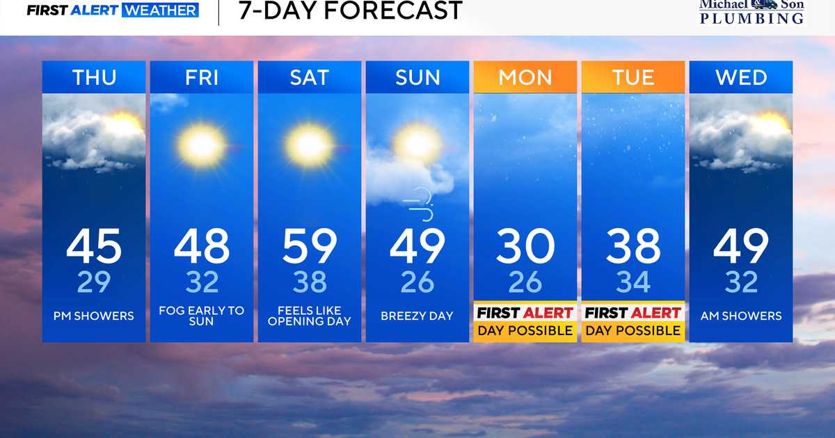
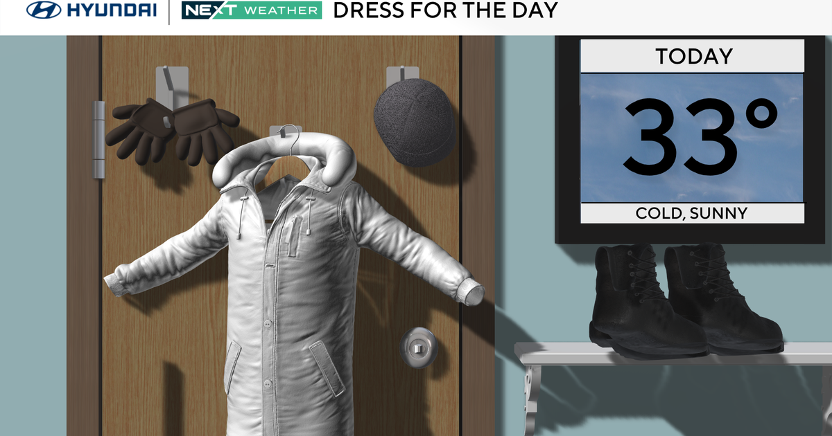
As for your Wednesday, it is a clear and cold one.
Mostly sunny skies will be accompanied by highs only near 30 degrees.
This could be a bit of a shock to the system after a high of 49 degrees on Tuesday at BWI Thurgood Marshall Airport.
We also have to take into consideration that north-northwest winds will make it feel 3-5 degrees cooler, so plan for the mid 20s.
Bitterly cold air settles in tonight with overnight lows in the low to mid teens.