Maryland weather: Rain chances to end the workweek

BALTIMORE - Overnight expect cloudy weather with patchy mist, drizzle, and fog. Lows will be in the upper 60s.
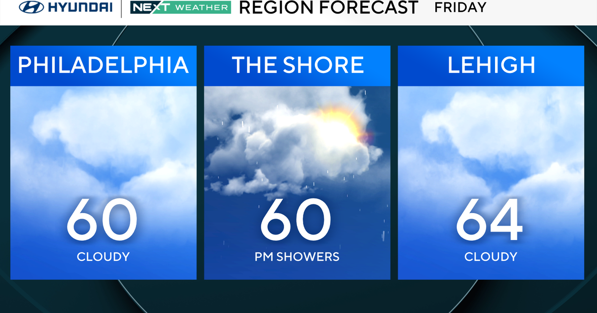
Friday will not be the best start to the Labor Day weekend. We'll see an easterly wind with plenty of clouds, scattered sprinkles and showers, and at times occasional drizzle. High temperatures area-wide will stay in the 70s with the coolest highs across Cecil and Harford counties where high temperatures will only reach the lower 70s.
A few more showers are possible as the back door cold front lifts north as a warm front Friday night into early Saturday.
Saturday looks very warm and muggy. Low clouds will break for at least slivers of sunshine. Highs will climb into the middle to upper 80s. Scattered strong storms are possible late Saturday afternoon, but especially Saturday evening. If we get enough sunshine, some storms could be severe with a damaging wind threat into the night.
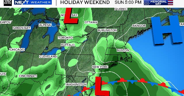
Sunday we'll see a few more scattered storms as the front slowly sinks south. The day won't be a washout, but plan on a possible hit or miss shower or thunderstorm.
Labor Day will be the winner of the holiday weekend with mostly sunny weather, low humidity, and highs near 80°.
High pressure will control our weather and bring in another refreshing Canadian airmass Tuesday through Thursday. High temperatures will only reach the middle to upper 70s with low temperatures dipping back down into the 50s. We stay dry through the end of next week!