Maryland Weather: Strong storms possible this evening
BALTIMORE -- Scattered thunderstorms will develop along the front from eastern Ohio toward the Philadelphia area.
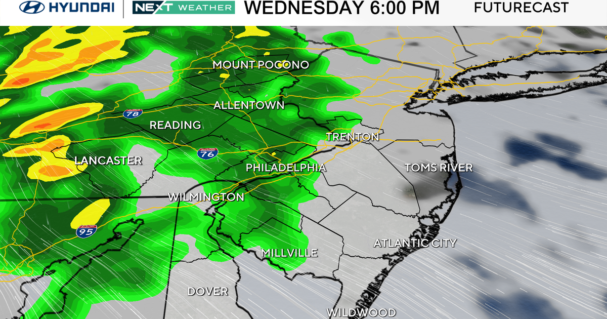
The best chance for strong to severe storms will be across the border in Pennsylvania.
Any storms that make it into the state will be capable of producing damaging wind gusts and locally heavy rainfall, potentially causing flash flooding in some areas. The highest risk for flooding will be in southeast Pennsylvania, northern Delaware, and northeast Maryland.
Low temperatures tonight will drop into the 70s under mostly cloudy skies, with a continuing chance of showers and storms as the front moves closer to Baltimore by Wednesday morning.
Wednesday will be mostly cloudy with a chance for showers and storms as the front lingers in the area throughout the day. High temperatures will be noticeably cooler, topping out in the lower 80s.
Temperatures will be even cooler on Thursday as clouds and moisture from the remnants of Debby spread northward across the region. Expect widespread rain for a portion of the day, with highs in the upper 70s.
The next round of heavy rain will occur when the main portion of what's left of Debby spreads across the region from Friday afternoon through Saturday morning. During this time, moisture from Debby will combine with the aforementioned front, posing a threat of locally heavy rainfall.
WJZ First Alert weather days are in effect for Friday and Saturday due to this heavy rain threat. The forecast has shifted slightly, with the heaviest rain now expected farther west. Areas along and west of I-95 have the best chance for significant rainfall, with totals potentially exceeding 4 inches in some areas by Saturday night. Common rainfall amounts of 2 to 3 inches are expected across the Eastern Shore and southern Maryland.
The system appears to be moving out faster than previously thought. Rain should begin tapering off quickly from southwest to northeast on Saturday afternoon. Dry weather is expected for the rest of the weekend, along with lower humidity.
Temperatures on Friday will remain around 80 degrees, with many areas staying in the upper 70s, particularly to the west of the track of Debby's remnants. Expect dry weather to begin next week, with our next chances for showers and storms returning by Tuesday and Wednesday. High temperatures will remain in the 80s through the first part of next week, with lows at night falling into the lower 60s on Saturday and Sunday nights.