Maryland Weather: Heat turns dangerous late week into weekend

BALTIMORE -- Heat and humidity continue through Thursday with dangerous heat this weekend.
High temperatures reached the lower 90s Monday afternoon across most of central and western Maryland. This was the first day of 90-degree temperatures in what will be a potentially long-lasting and intense heat wave by the weekend.
This evening expect a partly cloudy sky with temperatures easing into the 80s this evening and low temperatures in the lower 70s overnight.
This current stretch of hot weather will officially be labeled our first heat wave of the season if we reach 90-degrees Tuesday and Wednesday. Tuesday's high temperatures will be similar to Monday with the hottest weather located in and west of the City.
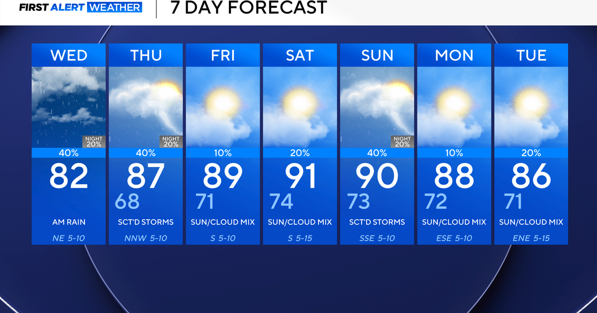
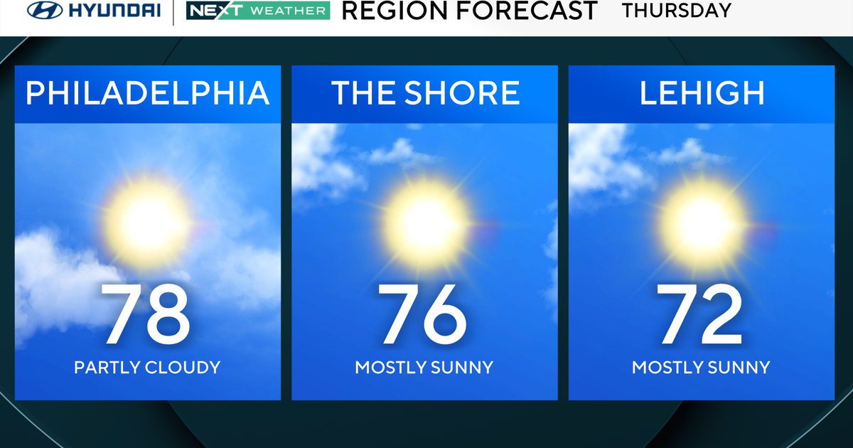
Tuesday through Thursday will be typically hot and humid for this time of year with high temperatures reaching the lower to middle 90s. Humidity levels will continue to be moderate, but not overwhelming during this time. The hottest neighborhoods will be located within Baltimore City and to the west and north of the City. Areas along Chesapeake Bay will see some relief with highs in the upper 80s.
Dangerous heat still seems most likely Friday through the upcoming weekend. Highs will reach the upper 90s to near 100 along with high humidity levels. This will cause feels like temperatures to surge into the 100 to 105 range with some isolated spots feeling even hotter. The WJZ First Alert Weather Team has issued ALERT DAYS for Friday through Sunday for dangerous heat.
It's important that you, your pets, and family stay hydrated, wear light weight, light colored clothing, take breaks inside in the A/C during this time. It's important when the heat is this extreme that your body gets at least a few hour break from the intense heat.
Isolated thunderstorms will be possible Saturday afternoon, especially in our western zones. Everyone in our area could receive hit or miss storms Sunday afternoon and evening. Another chance of scattered thunderstorms returns Monday. Monday should be the last day of intense heat with this current stretch with highs in the middle 90s.