Maryland Weather: Hot Friday, risk of weekend showers & storms

BALTIMORE -- Heat continues through Friday. Showers & storms are possible Friday night and chances continue through the weekend.
Thursday turned out to be another nice day, but hotter than recent days. High temperatures climbed into the upper 80s to near 90°. Luckily, humidity levels stayed manageable throughout the day. Expect a very nice evening ahead with a mainly clear sky. Temperatures will be in the 80s much of the early evening hours.
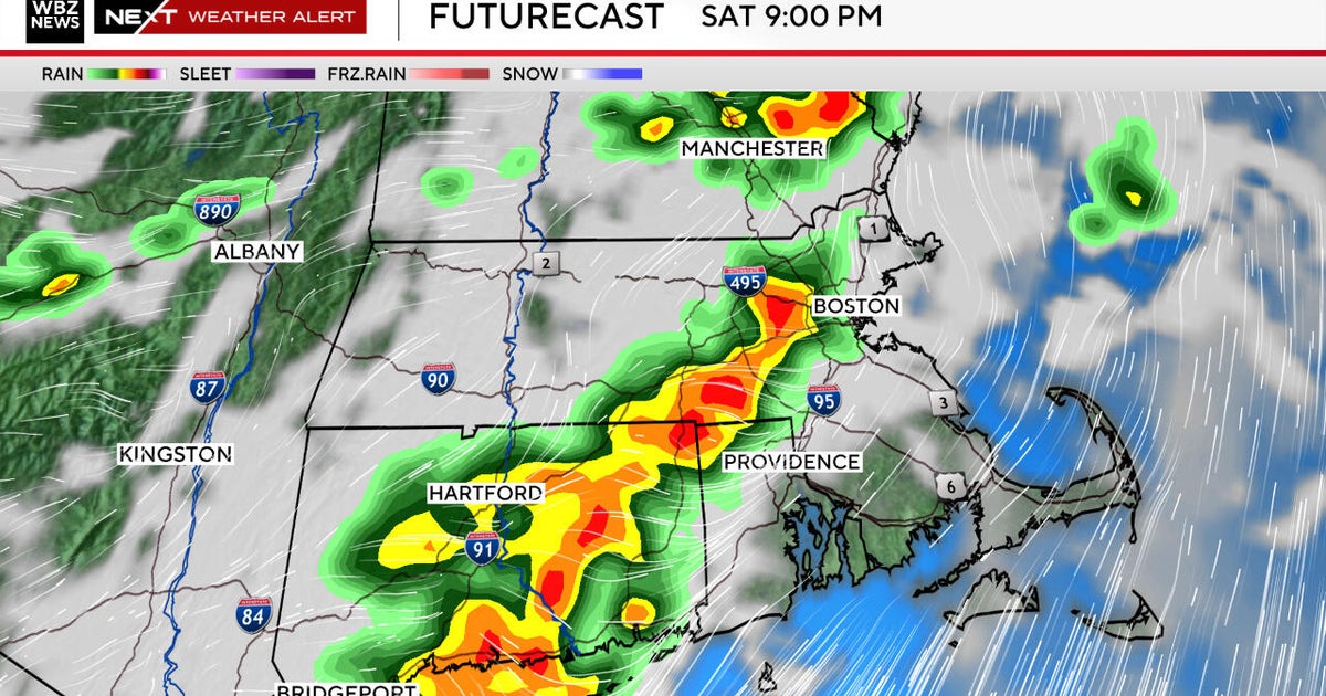
Friday will be another hot day with a mixture of sunshine and building clouds. Winds will be out of the south at 5 to 10 mph. Highs will top out in the upper 80s & lower 90s. The daylight hours Friday look mostly dry with just an isolated sprinkle or shower. A greater chance of showers & storms increases Friday night as a warm front lifts through the area. Some of the showers will linger into Saturday morning.
The forecast is trending less wet for Saturday. We'll still see a few scattered showers and sprinkles, but during the daylight hours look for variable clouds, warm, and muggy weather. The cold front that was expected to bring us numerous showers & storms is moving a bit slower and won't arrive until late Saturday night. Since the storms won't have the heat of the afternoon as fuel, most should not be severe.
If you're headed to the Ravens preseason game at M&T Bank Stadium, I'd still bring a rain poncho just in case. However, the game will be far from a washout. Temperatures will be in the 80s with high levels of humidity.
A greater risk of showers and locally heavy thunderstorms is possible on Sunday. Our WJZ First Alert Weather Team has declared Sunday as a possible First Alert Weather Day. There still is some uncertainty as to how strong the storms are on Sunday. If we get more sunshine during the morning, storms will likely be stronger in the afternoon and evening. This would warrant an upgrade to an Alert Day. If clouds and showers linger Sunday morning, the possible Alert Day will likely be dropped. Expect another warm and muggy afternoon with highs in the upper 80s.
More showers and storms are likely on Monday as a strong cold front crosses the area. This cold front will help keep "Ernesto" well offshore. However, we'll still experience dangerous rip currents along Delaware and Maryland Atlantic beaches. Please listen to lifeguards and only swim while they're on duty.
Crisp, low humidity air returns Tuesday and lingers into next Wednesday providing us another stretch of amazing weather.