Maryland weather: Hot temperatures return with evening storm chances
BALTIMORE -- The big story this week weather-wise will be the rising temperatures and humidity creeping up each day through the end of the week. It will be noticeably more humid tonight with partly to mostly cloudy skies and low temperatures in the low to mid-70s.
On Tuesday, expect partly to mostly cloudy skies with a chance for showers and possibly a storm. More cloud cover will lead to cooler temperatures across the region, with highs reaching the mid to upper 80s.
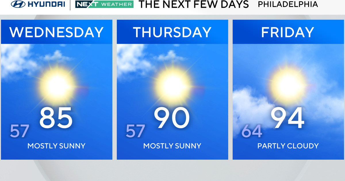
The heat will surge across the area as we head into the middle of the week, and it will be noticeably hotter on Wednesday. High temperatures Wednesday afternoon will top out in the mid to upper 90s, and the same is expected on Thursday and Friday.
Heat index values will not be as high as they have been with previous heat waves this summer, but they will still top out close to 100 degrees in many locations, particularly on Thursday and Friday.
There will be chances for showers and thunderstorms each afternoon, with the best chances occurring on Friday. Wednesday and Thursday's chances will be isolated, likely restricted to areas close to the Bay and the higher elevations of Western Maryland.
After Friday's storm chances, a front will slowly push through the area during the first part of Saturday, bringing another chance for showers and storms, mainly in areas east of I-95. Otherwise, the weekend overall looks decent. Aside from the chance for storms on Saturday, expect plenty of time to enjoy outdoor activities and a slight drop in humidity as we head into the first part of Sunday.