Maryland Begins To Dry Out After Tuesday's Record Rainfall
BALTIMORE (WJZ/AP) -- Maryland is beginning to dry out after Tuesday's record-setting rainfall. Parts of Maryland dealt with flooding and the state broke records.
Ron Matz reports 6.31 inches of rainfall was recorded at Baltimore Washington International Thurgood Marshall Airport.
Not since 1933 has Baltimore recorded a rainfall that matched Tuesday's deluge.
That is the highest total recorded for the city in a single day since a 1933 hurricane that measured 7.6 inches--even surpassing what we got when Superstorm Sandy occurred. Tuesday's rainfall also marks the second-highest total since measurements were first taken in 1871.
This puts us at nearly a foot above average for the year as far as precipitation is concerned.
Some areas received even higher totals. The weather service reported 10.3 inches of rainfall in Green Haven in Anne Arundel County.
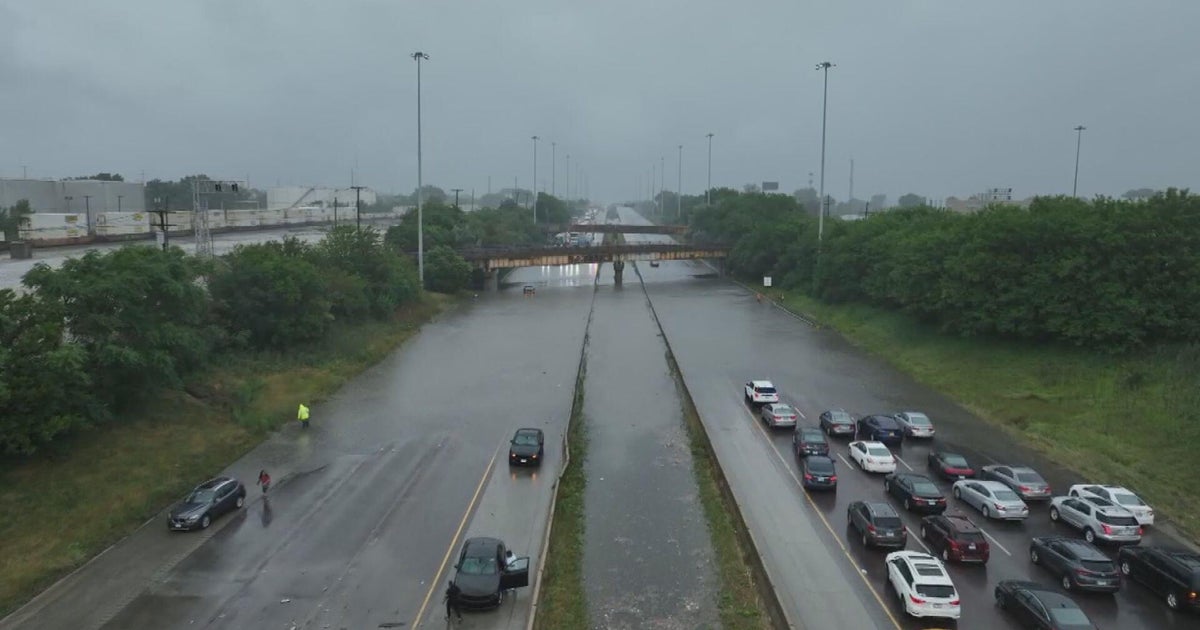
The rainfall caused flash flooding Tuesday that necessitated several water rescues around the state.
In Baltimore City, streets flooded in Cherry Hill and Northpoint Boulevard. Near Hopkins, overwhelmed sewers overflowed, sending raw sewage into the streets.
And at BWI, several parking lots were underwater with water above the wheel wells of some cars. Officials there say the water is starting to recede, but there are now concerns that some cars won't start.
There were 17 water rescues across Maryland.
The good news is that the heaviest rain occurred in areas close to the Chesapeake, where rivers can more easily drain into the bay.
Other than a lingering shower east of I-95, clouds will begin to break and sunshine will return by Wednesday afternoon.
But while the rain has stopped, emergency officials are warning drivers to watch out for flood waters that have yet to recede.
(Copyright 2013 by The Associated Press. All Rights Reserved.)
Other Local News:
