Pittsburgh Weather: Winter Storm Scenario Looking To Unfold Later This Week
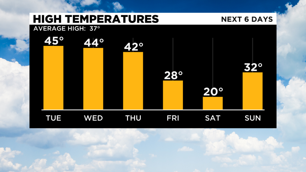
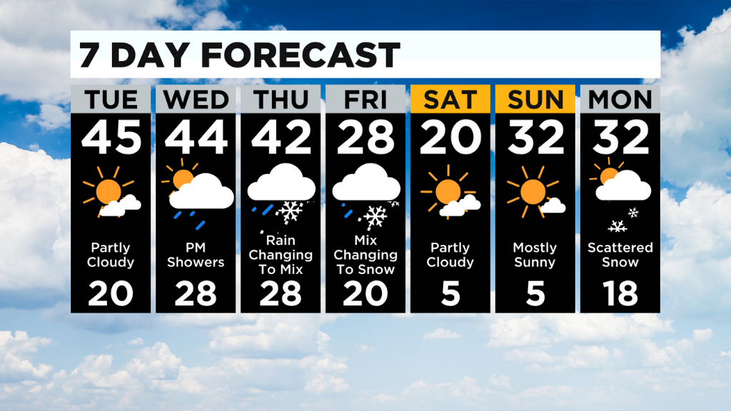
PITTSBURGH (KDKA) - The warmer temperatures in the next couple of days may make it harder for our minds to wrap around the winter storm scenario that is looking to unfold later this week. Highs will reach into the mid-40s both Tuesday and Wednesday. This will lead to a lot of melting for the next 48 hours.
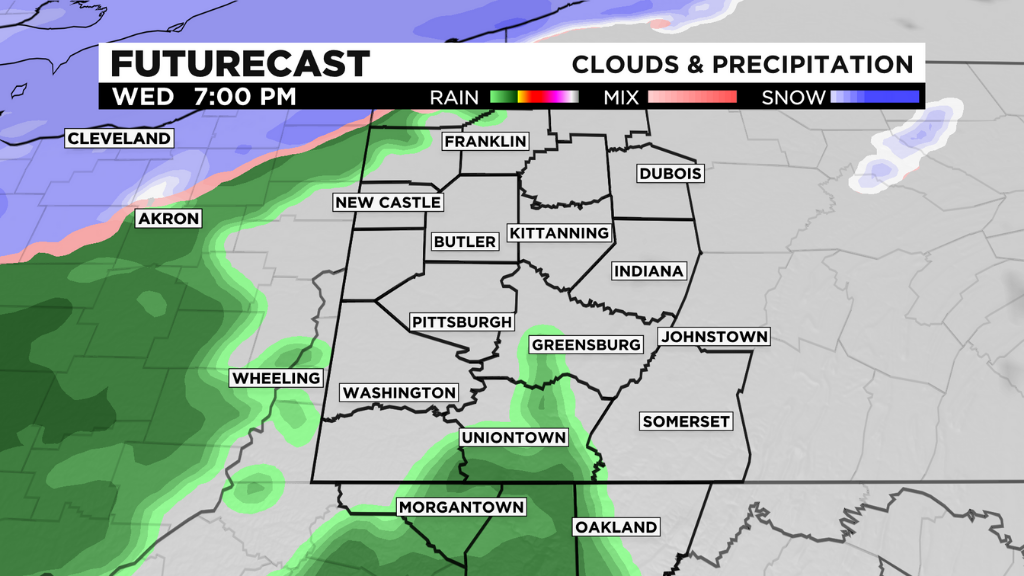
Wednesday, especially late, rain will develop. This rain will lead to our winter storm system's impacts later this week.
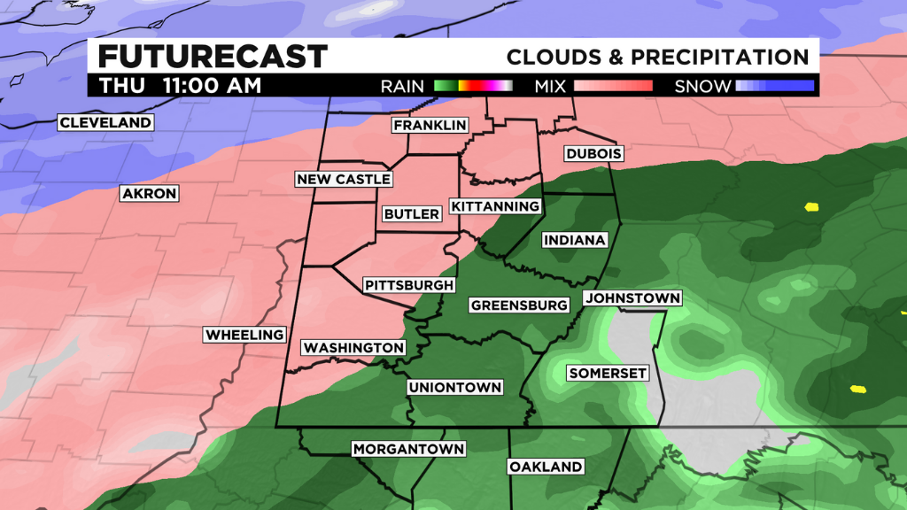
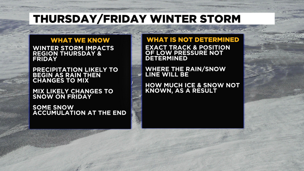
That rain, on the current paths, looks to transition to a wintry mix and freezing rain early Thursday. This could lead to commute issues if this timing holds.
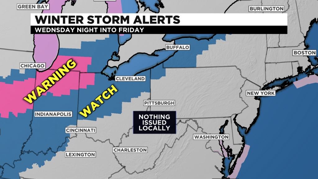
From there, this wintry mix will transition to snow on Friday. Accumulations are possible with this. Winter storm watches and warnings are already being posted in areas north and west. I am anticipating watches to be issued locally at some point on Tuesday. As a reminder, watches are changed to warnings or advisories as the storm gets closer.
The path the low-pressure center takes will dictate precipitation placement and type. While there is some consensus among a couple of models, we still have outliers which keep some questions up in the air. Hopefully the model runs in the next 24 hours will start clearing those questions up.
Much colder temperatures will be around for the weekend.