Philadelphia Weather: Complex Storm System To Bring Wintry Weather To Delaware Valley Sunday, Monday
PHILADELPHIA (CBS) -- A complex storm system will impact the Philadelphia region to end the weekend, bringing us another chance for wintry weather. Round 1 arrives on Sunday and Round 2 will hit the region on Monday. Unfortunately, this comes at an inconvenient time as most holiday travelers will be heading home these days.
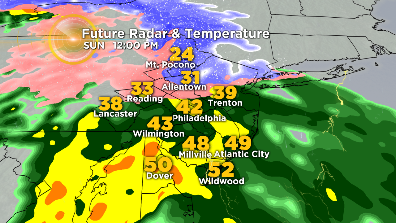
A wintry mix will likely develop early Sunday morning. The precipitation will have to overcome some dry air in the lower levels of the atmosphere before it starts to reach the ground, which explains the scattered nature of it on our future radar.
Once the atmosphere moistens up, we could see a mix of sleet and freezing rain in Philadelphia and points north before changing over to cold rain.
Keep in mind that this forecast is highly dependent on temperatures. If the precipitation moves in earlier, the mix may be more widespread, whereas if it moves in later -- and dry air wins out -- we would see more rain and less mix due to higher temperatures.
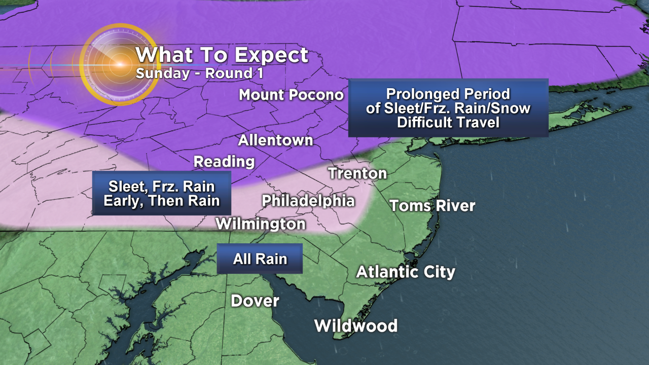
The changeover should happen pretty quickly in the Philadelphia area, probably by mid to late morning -- so impacts should be very minimal, if any at all.
However, the wintry mix will persist into the afternoon across the Lehigh Valley, Poconos and some of our western suburbs, which could make travel difficult throughout the day.
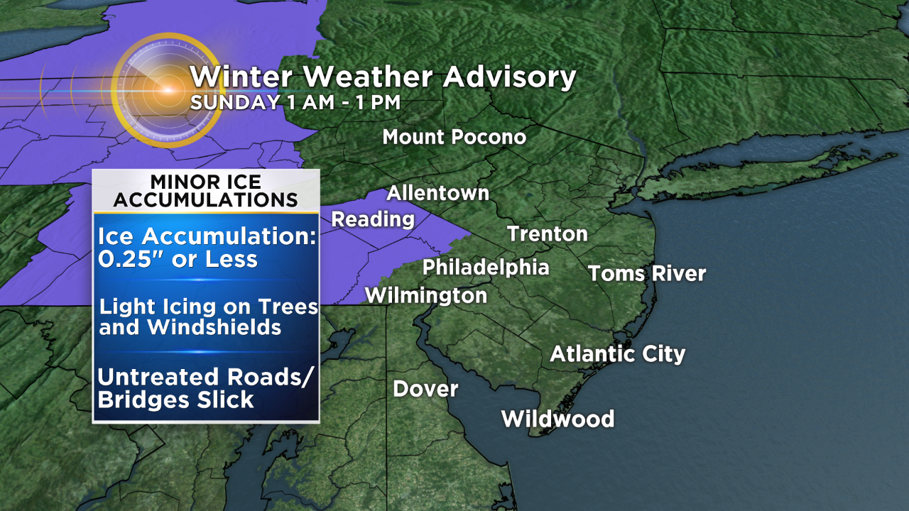
Ice accumulations are expected to be less than 0.25-inch, so expect minor impacts. To account for this, a Winter Weather Advisory has been expanded to include Philadelphia and all Pennsylvania suburbs from 3 a.m. to 1 p.m. on Sunday.
Windshields and tree branches will likely have a coating of ice and untreated roads/bridges will become slick in these areas -- use caution if traveling.
A Winter Storm Watch is in effect for Lehigh Valley, Upper Bucks County and the Poconos.
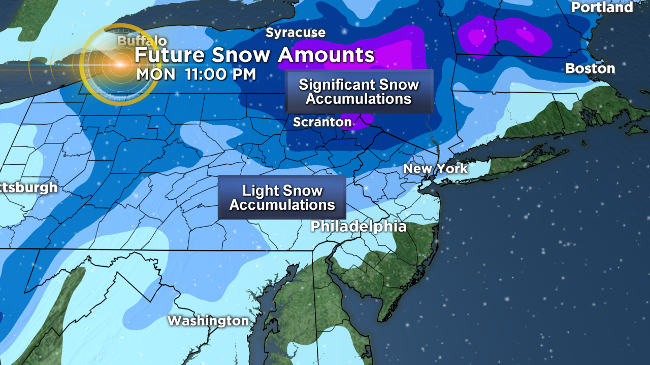
Round 2 of the wintry weather rolls into the region on Monday.
An area of low pressure will develop offshore late Sunday into early Monday and then strengthen.
As this happens, colder air will wrap in on the backside of the system.
This will allow any rain to change over to snow from north to south across the region. The location of the area of low pressure in relation to the Delaware Valley is key to how much snow we could potentially see.
Accumulating snow will be possible across the entire Delaware Valley, including Philadelphia. But right now it looks like the best chances will be for areas north and west of the city.
Significant snow could fall across the Poconos and parts of the New England region.
But we are still two days out, so things will likely change and we will continue to update our forecast Sunday and Monday.
Travel will be impacted on both days -- so stay safe and be careful on the roads.
By: Tiffany Savona