Philadelphia Weather: Winter Weather Returns To Region
PHILADELPHIA (CBS) -- After seeing record warmth last weekend, it's back to reality this weekend! Colder air has moved in and we are tracking wintry weather on Saturday.
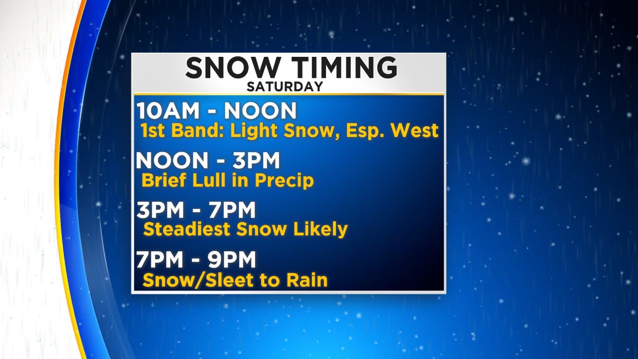
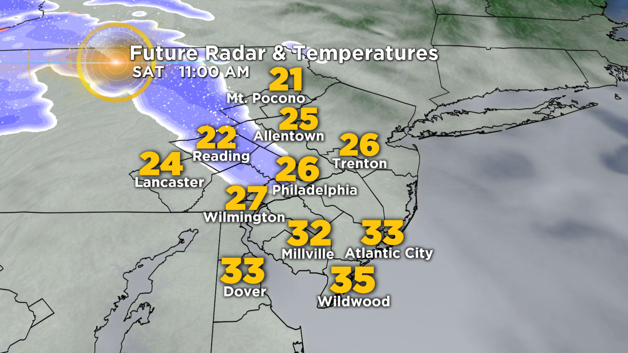
Saturday morning will start off dry and cold with temperatures in the 20s. The first wave of snow will move in during the late morning/midday hours. We have very dry air in place in the lower levels of the atmosphere, so this first band of snow will probably evaporate before reaching the ground. We may see a few flakes out of it, but that is probably about it.
However, if the atmosphere moistens up quicker, then snow could begin to fall during the morning hours.
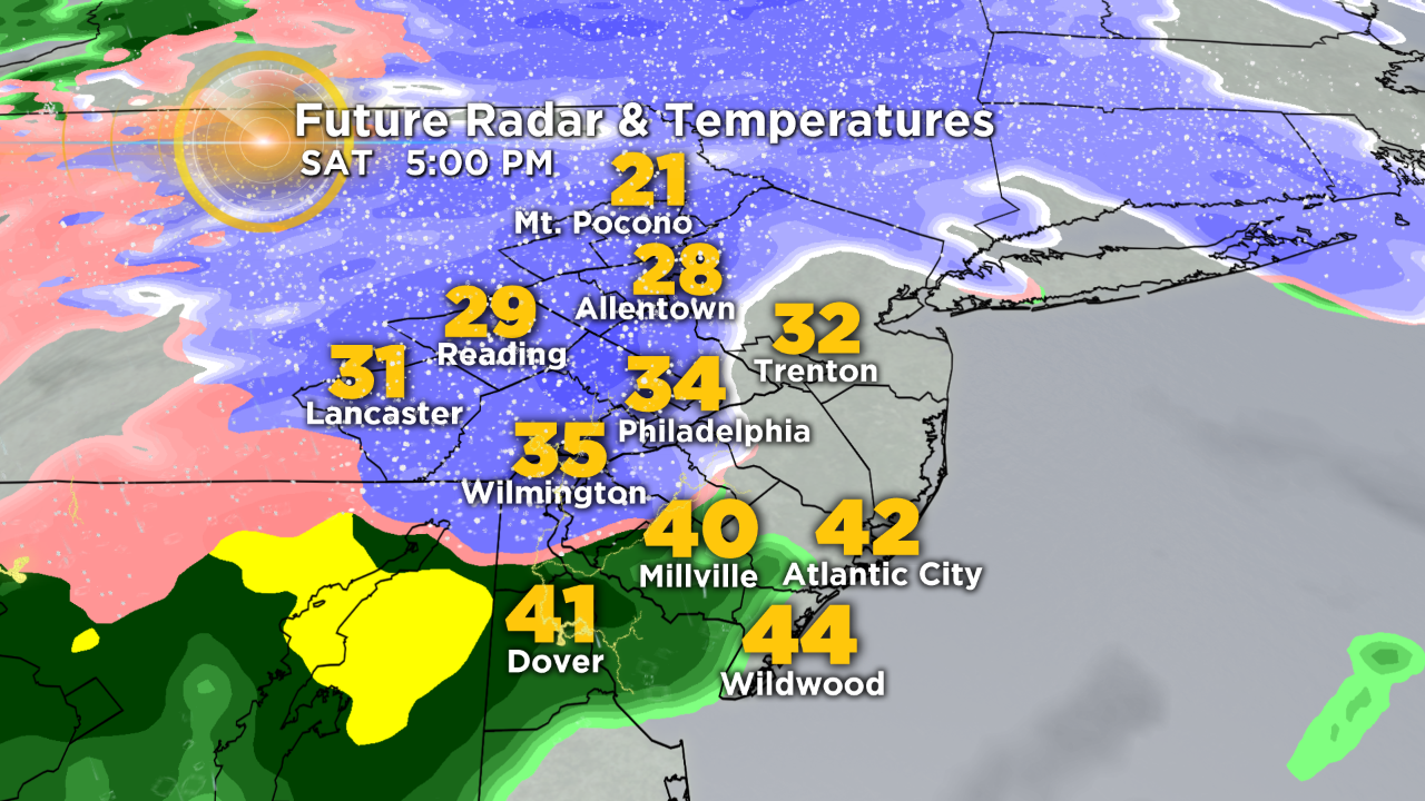
There have been some changes to report since yesterday. Now it looks like we will see a lull in the precipitation, from Philadelphia and points south, for a few hours early this afternoon (approx. 12 p.m.-3 p.m.). Computer models have slowed down the arrival of the second wave of snow. Steady snow looks to now push in later this afternoon (approx. 3 p.m.-7 p.m.).
Once the snow begins to fall, it should accumulate with surface temperatures around, if not below, the freezing mark. If the snow comes down heavy enough, there is a chance roads could become slick for a period of time.
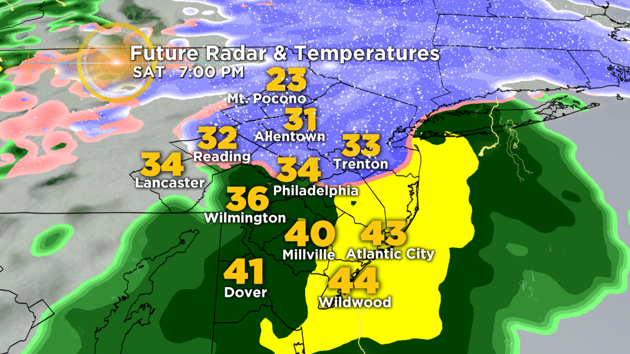
Warmer air will be moving in from the south, so snow may mix with sleet before changing over to rain Saturday evening. If we see more sleet, then a light glaze may develop on cars and elevated surfaces. Once we see the changeover to rain, the snow will begin to wash away and become a slushy mess as temperatures rise above freezing. The steady rain and snow will come to an end before midnight, but we can't rule out a few rain showers overnight.
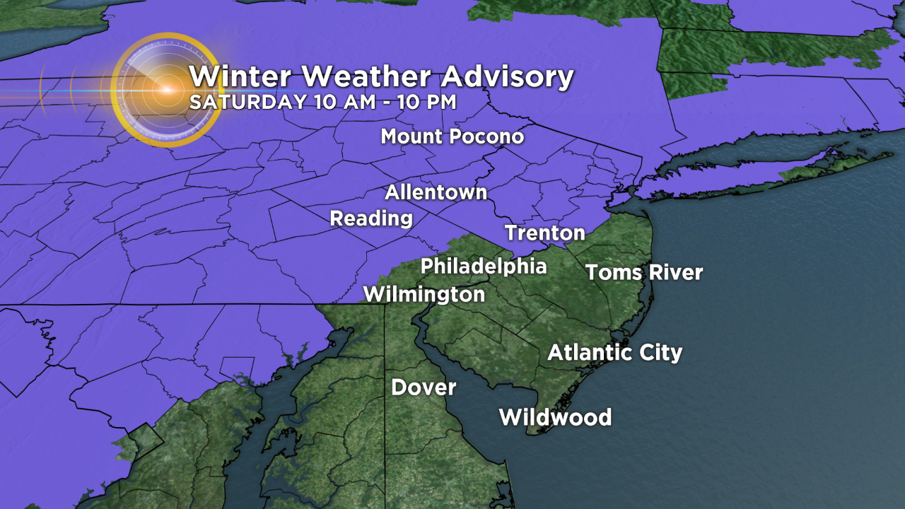
A Winter Weather Advisory is in effect for the Poconos, Lehigh Valley, Upper Montgomery County, Western Chester County and Bucks and Mercer Counties until 10 p.m.
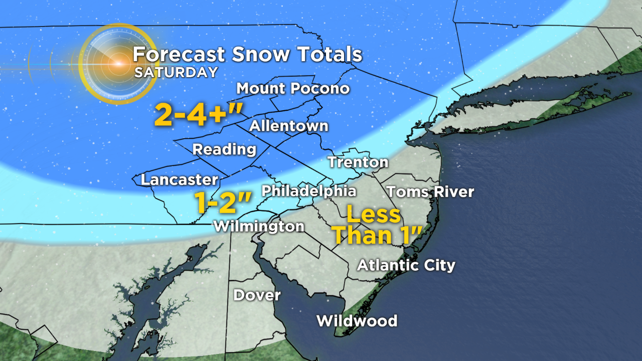
This is where the cold air will hold on a little bit longer and the changeover won't happen until later Saturday night. Thus, our highest forecast snow totals are for areas north and west of the city.
Keep in mind these are potential snow totals before the changeover to rain. Once the rain arrives, it will help to wash away the snow that just fell.
Once the snow changes to rain and temperatures rise above freezing, road conditions should improve.
Road conditions may be worse across the Lehigh Valley and Poconos, if the snow doesn't change over to rain and temperatures remain below freezing.
Keep in mind that there are still a lot of questions regarding this storm and how it will perform across the Delaware Valley. Snow totals largely depend on how quickly we can erode the dry air in place and how fast we see the changeover from snow to rain.
We will continue to monitor the latest conditions and will keep you updated throughout the weekend. Stay tuned for the latest forecast.
CBS3 meteorologist Tiffany Savona reports.