NASA: The worst of El Nino is still to come
NASA says this year's El Nino "shows no signs of waning," and its biggest impact on the U.S. is expected to hit early in the new year. The latest satellite imagery suggests the current El Nino is on track to rival or even surpass the biggest one ever recorded, in the winter of 1997-98.
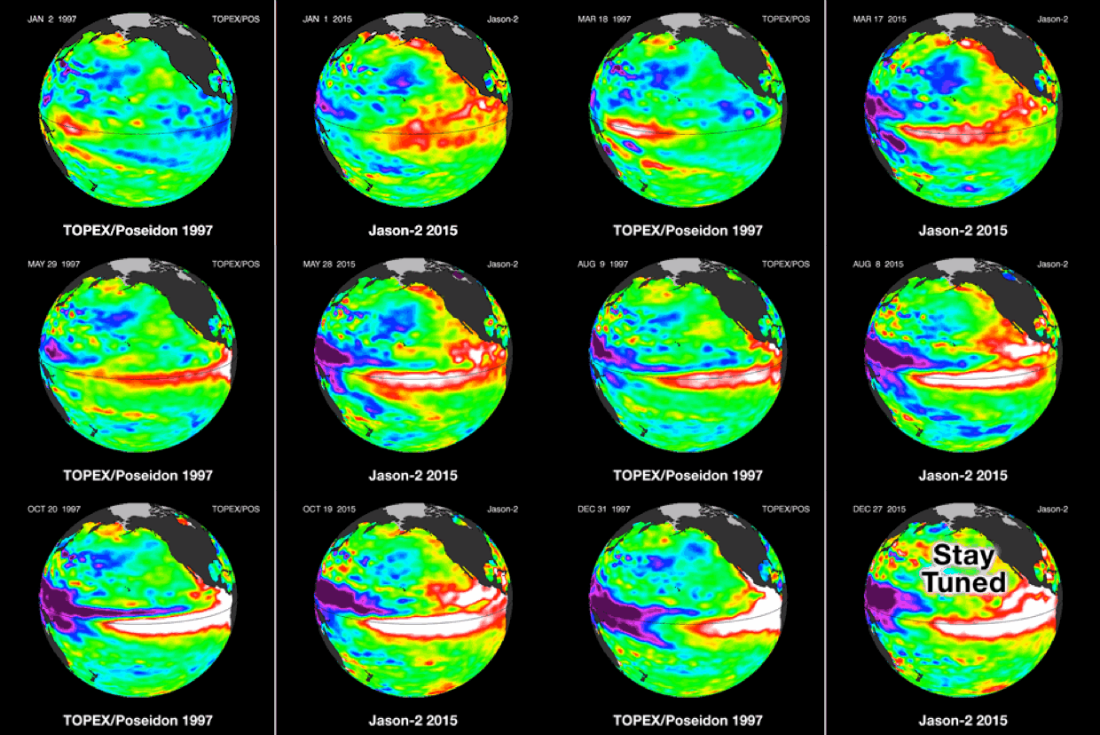
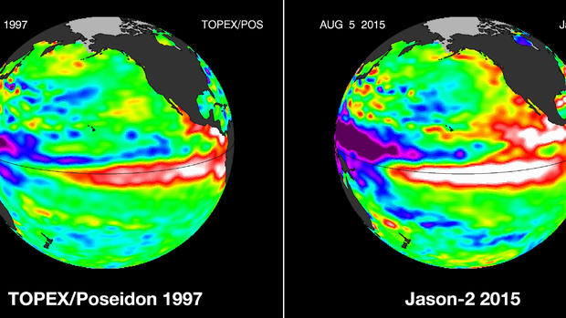
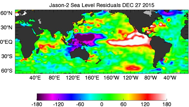
The satellite images show similar, unusually high sea surface heights along the equator in the Pacific Ocean, an indication of warmer waters -- "the signature of a big and powerful El Nino," NASA said in the latest update posted online. The warmer ocean waters pump heat and moisture high into the atmosphere, altering the jet stream and affecting storm tracks all over the world.
A comparison of the satellite images shows that 1997's El Nino peaked in November, while this year's is impacting a larger area of high sea levels in December. "This could mean we have not yet seen the peak of this El Nino," said Josh Willis, project scientist for the Jason satellite missions at NASA's Jet Propulsion Laboratory (JPL).
This year's pattern, dubbed the "Godzilla El Nino," has already been bringing more rainfall and snow to the West Coast. On Wednesday, California officials reported that snowpack in the Sierra Nevada -- a significant source of the state's water supply -- has reached 136 percent of normal level.
That's generally welcome news after years of drought -- but heavy precipitation also raises the threat of severe flooding or mudslides.
The strong El Nino of 1997-98 nearly doubled the average rainfall for Southern California and fueled fierce storms that killed at least 17 people across the U.S.
In addition to its impact on the West Coast, a strong El Nino can bring more precipitation across most of the south and up the East Coast. Northern states are likely to have a drier and warmer winter than average.
Meteorologists say El Nino helps explain why this December broke high temperature records as the eastern half of the country basked in 60- or even 70-degree weather the week of Christmas.


