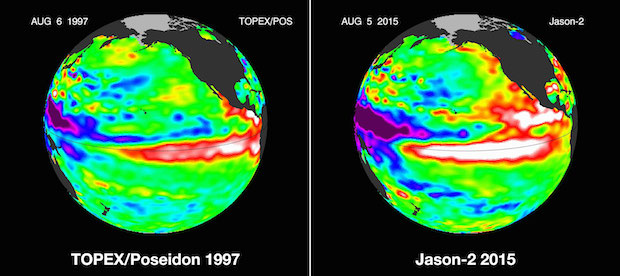
Forecasters warn that "Godzilla El Nino" could hit U.S.
Forecasters are warning the West Coast could be hit by what may possibly be the strongest El Niño season on record later this year.
Forecasters with the National Oceanographic and Atmospheric Administration's Climate Prediction Center told reporters Thursday warming ocean waters nearing North and South America could bring some much-needed rain -- along with some other potentially hairy weather -- to the region in what one climatologist described as a "Godzilla El Niño".
An El Niño -- meaning in Spanish "the little boy, or Christ child" -- is created when the equatorial waters of the Pacific Ocean warm significantly.
Expected to peak in the late fall or early winter, the annual weather phenomenon may yield more frequent and intense storms than in past seasons, along with an increase in tropical cyclones in the Pacific and heavy rainfall and snowfall.
"If it continues to build this will have a tremendous impact not only on North America, but over the entire planet," Climatologist Bill Patzert told CBS News.
In the United States, a strong El Nino can bring more precipitation across most of the south and up the East Coast. Northern states are likely to have a winter that is drier and warmer than usual.
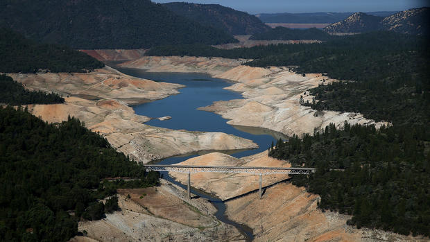
Californians know El Nino can bring both bad and good. After years of drought, now they are praying for rain.
In July, UC Irvine hydrologist Amir Aghakouchak told CBS Los Angeles that the predicted El Niño rains could result in excessive stress on levies, roads and hillsides that have started to dry and crack in California's historic drought.
"We cannot stop them, but we can try to be more and more prepared," Aghakouchak said. "Natural hill slopes are becoming more and more vulnerable."
But despite the predictions, NOAA scientists say even if the West Coast sees above normal rain and snow this winter, the amount of precipitation won't be enough to erase four years of record-breaking drought conditions for California.

